Pick your prime meridian

On Earth, the line of zero degrees longitude runs through Greenwich, England. What about other planets?

Unlike latitude, longitude has no physically defined starting point. Zero degrees of latitude is at a planet’s equator and is easy to establish from the body’s rotation (although as noted by Wikipedia, technically it also depends on the “reference ellipsoid” chosen to model the body). In contrast, zero degrees of longitude can be wherever you want it to be. However, change it with caution: any modifications mean that all of your previous maps and published locations have to be updated!

This happened on Mars. Originally (1830), the line of zero degrees was set to be a point in a dark region that was 40 years later named (due to its utility) Sinus Meridiani (get it?).

In 1969, it was decided to change the prime meridian to go through a specific crater named Airy-0 (a smaller crater inside a bigger one named Airy). This was thanks to the higher resolution images that the Mariner 9 spacecraft generated, enabling the selection of a smaller, more precise, reference point. Each time we send higher resolution cameras to Mars, we get to see more and more details of this crater:


Airy-0 (top crater in each image) as seen by (A) Mariner 9 in 1972,
(B) Viking 1 in 1978, and
(C) Mars Global Surveyor in 2001.

However, this crater is still large enough (500 m across) to not be a very satisfying reference point to measure distances to other features. If you use a yardstick to measure that distance, where inside Airy-0 should one end of your stick go? You want your reference point to be as small as possible so that everyone measures distance the same way.

What do we have on Mars that is very small but very recognizable? Our landers!

But we don’t want to pick a new prime meridian. If we did, we’d have to change all our maps and localized data — a huge and infeasible task.

Instead, Mars cartographers did something very clever. They kept Airy-0 as the 0 point, then carefully calculated the longitude of the Viking 1 lander with respect to the center Airy-0. Why that lander? Because it’s been there the longest, so it provides a consistent reference point for all data going back to 1976. At the time Viking 1 landed, its location was known only to within 0.1 degree (~6 km). Its location is now known much more precisely. I was unable to find the exact number, but it’s at least an order of magnitude better. So today, all longitudes of Mars surface features or objects can be calculated with reference to the Viking 1 lander (at 48.222 deg W, not 0), enabling much higher precision in localization!


Viking 1, the lander that keeps on giving

This issue has become even more challenging with the discovery of exoplanets – including some for which we are starting to make maps. How shall we pick their prime meridians, without being able to see surface features?

Memory tricks that work

I enjoy learning about ways to improve my memory, or even other people’s attempts to improve theirs, as in Moonwalking with Einstein. The method of loci (or memory palace) technique is pretty cool, and I used it to memorize some flying-related info. But you know, it took effort!

The other day, I was listening to Jim Kwik’s podcast, Kwik Brain. The tone of the podcast is a bit too self-promotional and get-rich-quick-y for my tastes, but the episodes are short and I can skip over the annoying parts and listen to the rest at 1.5x (sorry, Jim!). But the fact is, in a recent episode he managed to get me to memorize the first ten elements in the periodic table… without even trying! (Much?) And I can reel them off forwards or backwards! Even now, weeks later!

To do this, Jim created a colorful little story.
Imagine a fire hydrant. (The more vividly/crazily/ridiculously you imagine each item, the more it will stick!) Attached to it is a helium balloon. Then some batteries smack into the balloon. They were launched from a barrel. There’s a board leaning against the barrel. A diamond rolls down it! Into … Knight Rider! Which is stuck between two oxen. They have nasty teeth, so you brush the oxen teeth with toothpaste. Next to you is a huge neon sign in flashing colors.

Bizarre! But you’ll remember it. And then…

The fire hydrant = hydrogen.
The balloon = helium.
The batteries = lithium.
The barrel = beryllium.
The board = boron.
The diamond = carbon.
Knight Rider = nitrogen.
The oxen = oxygen.
The toothpaste = fluorine.
The sign = neon.

Not only do you remember this, but you can walk backwards through the little scenario, from neon sign through Knight Rider all the way back to the fire hydrant, and recite Ne – F – O – N – C – B – Be – Li – He – H! Effortless!

This seems so easy when someone already came up with the mnemonic associations. Now I just need to get better at creating them.

He also talked about using your body to anchor a list (e.g., of shopping items). So you imagine item 1 on the top of your head (e.g., milk pouring down your head), then item 2 on your nose (e.g., strawberries stuck up your nose), and so on with mouth, ears, shoulders, fingers, belly button, seat. Or as many places as you need. I tried this the other day and it also worked.

But just like the method of loci, I have to wonder how many times you can re-use the same memory palace (“memory body”?). Wouldn’t the previous set of associations bleed over and get mixed up? Do I need bread this week, or was that last week’s belly button item? Indeed, the advice I’ve seen is to not re-use memory palaces… which seems pretty limiting in terms of the number of things you can memorize this way (although advocates claim that we interact with so many physical locations that you should never really exhaust your options). But maybe don’t re-use your body. :)

Flying to the Grand Canyon

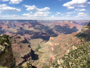
Last weekend I flew the farthest that I’d yet gone as a pilot – to the Grand Canyon! It was a short overnight trip, with enough time to fly there, go for a beautiful hike, spend the night, and then fly back the next day.

I took the outbound leg, and my friend Manuel flew us back. The Grand Canyon airport (KGCN) is about three hours of flying from El Monte. After factoring in enough fuel for an alternate destination plus an extra 45 minutes of flying time (my standard margins), it just fit in the plane’s 38 gallons of usable fuel. (Originally I’d planned Valle as my alternate, only 18 miles from GCN – but in my pre-flight research I learned that it no longer sells fuel! The next closest option is Kingman, 97 miles from GCN!)

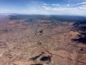
The usual June gloom meant an early morning start wasn’t possible, so we departed around 10 a.m. We climbed above the haze layer and kept going on up to 9500′. It was a bit clearer (but not entirely) once we crossed the mountains into the desert. We were on our way!

Three hours can be a long time in a plane. I entertained myself by tracking VORs in addition to the GPS. Then things got more challenging as some light turbulence set in. In addition to bumping around, we got a roller coaster feeling from a series of updrafts and downdrafts that would send us suddenly climbing or descending at 500 fpm. This required active attention to manage (pitch and throttle), especially given the occasional nearby traffic which made it very important to stick to our planned altitude. It is a funny feeling to be fighting that kind up updraft – nose pointed down yet fighting to avoid gaining altitude! It felt kind of like surfing! Also, I got to make a PIREP for light turbulence :)


Approaching the Canyon!

As we approached GCN, the winds were reported to be from 260 at 11 gusting to 18 knots. We were landing on runway 21, so that’s a healthy crosswind (with gusts). GCN is also high enough (6600′) that you need to be mindful of your mixture and prepared for faster groundspeed (as I’d trained two days earlier with a trip to Big Bear).

I entered right traffic and the tower gave me an altitude restriction – a first for me – in which I was not allowed to descend more than 300′ below pattern altitude until established on final. As I approached, I spotted a helicopter maneuvering below and figured out why I needed to stay high! I extended my downwind a bit to keep a healthy distance from the helicopter (their direction and speed are extremely hard to anticipate), then turned final as the helicopter went to its helipad. I landed without incident, marveling at the wide runway! I didn’t notice much of a crosswind so I think the winds had died down a bit.

Other things I learned on this long(er) flight:

  • Managing and transitioning between four different VFR charts with a kneeboard is a challenge!
  • Sometimes LA Center is just too busy and you get to “see and avoid” without flight following for a while :)
  • The PGS VOR seemed to be dead. Thank goodness for GPS!
  • It is possible for tach time to exceed Hobbs time!
  • It is hard to find good visual checkpoints when flying over the desert.
  • Sometime I want to try doing a flight via dead reckoning and see whether I can actually get to my destination using my planned headings and time durations for each leg. There’s so much uncertainty in predicted winds aloft and other sources of error that I’m not sure it’s possible to get to actually reach destination that’s three hours away – but pilots of yore did!

We tied down the plane and ordered fuel. We had consumed 24 gallons in 2 hrs 45 mins of flight – pretty good for this plane (my leaning was effective)! We had also benefited from a ~30-knot tailwind. We hit all of my predicted checkpoints almost precisely! I enjoy planning out the flight log and then tracking progress as we go.

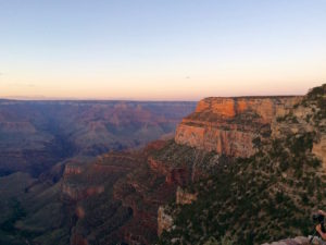
We took a shuttle to the Grand Canyon itself and got in a lovely 3.5-hour late afternoon hike. The Grand Canyon is breathtaking from the top and from every switchback down the trail! We hiked down about 2.5 miles, then back up to watch the sunset from the rim.

The METAR and TAF the next morning included “FU” (smoke) – the first time I’ve seen it in reality! They were doing controlled burns north of the airport. The smoke was gone by the time we departed.

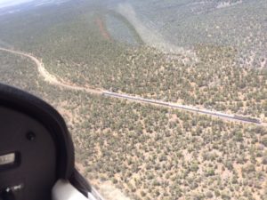
On the way back, I got to be a passenger and take lots of pictures. :) As we departed the airport, the Grand Canyon Railway train slid by right under us! What a treat!

High-altitude takeoffs and landings

Yesterday I had a lesson on high-altitude flying. We went up to Big Bear airport (L35) in the mountains above Los Angeles. Big Bear is at 6700′, and that plus some intervening ridges meant we chose a cruise altitude of 9500′. It takes a long time to climb from 300′ to 9500′ on a warm day! Big Bear is 60 nm from El Monte, and it took us over halfway to get up to 9500′.

The goal of this lesson was to learn not only about flying at high altitudes, but how to take off and land at high altitudes. The challenges arise from the fact that the engine’s performance is greatly reduced and the thinner air means the wings develop less lift. Here’s a terrifying tale of how not to do it. Big Bear is also nestled in the mountains, so there are some additional factors to consider in terms of likely updrafts and downdrafts and being mindful to always have one or more exit strategies in mind. Don’t get boxed into a canyon!

The winds were a little odd when we arrived – crosswind and gusty, and mildly favoring runway 8, which points into a forested area, as opposed to runway 26, which points into a lake (which therefore poses fewer obstacles). See image at right for what it looks like approaching runway 8 (image credit Mead & Hunt).

We tested it out by starting with a low approach over the runway – 300′ up, 70 kts, 10 degrees of flaps. We did NOT go full rich as I would normally do. That was my first deliberate low approach, and I’d been curious about how to do it. This meant I got to see how the winds actually felt near landing, without fully committing; midway down the runway, we went full power and did a go-around. Indeed, I could feel the crosswind and some airspeed oscillations from the gusts. And the climb out was weak, even at full throttle. And there were definitely up- and down-drafts and bobbling turbulence in various places. Still, nothing we couldn’t handle.

We came back around for an actual landing, which was beautifully smooth. I had pre-calculated the likely landing distance given the temperature and altitude, which was about 700′ (versus 570′ at EMT – not much difference) and indeed, it felt like a pretty normal landing.

We taxied back for takeoff and there I got to learn how to lean the mixture to get max performance – stand on the brakes, full throttle (only getting 2200 rpm when full rich!), then lean the mixture out (increased to 2400 rpm) but not too lean (we aimed for an EGT of 1300 F). Then – takeoff! I’d also calculated the takeoff distance (1440′ compared to 825′ at EMT) and this time I did notice that it took longer than I’d expect to reach rotation speed. But Big Bear has a 5800′ runway, and that’s tons more than a Cessna 172 needs to take off, even in those conditions (density altitude was about 8500′).

We also practiced an aborted takeoff – a surprise event that my instructor called just as I was about to lift off. Pull throttle to idle, keep the nose up, maintain directional control. Again, plenty of runway for us to slow and stop. This is a great option if the plane just isn’t developing enough speed or anything feels or sounds wrong.

In general, flying at Big Bear was challenging but doable. I felt that it was within my ability to keep the plane under control and doing what I wanted it to – but it took a lot more attention than usual, between the reduced performance, turbulence that induced sudden banks, altitude changes, and airspeed changes, and the gusty (and strongly variable) crosswind that kept playing with me as I’d approach to land. My instructor commented that in those conditions, it’s more about keeping the plane within a box of desired performance, since you can’t micromanage it to stay nailed on airspeed, altitude, descent rate, etc. with the constantly changing conditions.

Now I’m ready to fly to the Grand Canyon! (Almost the same altitude as Big Bear!)