Flying by instruments to San Diego
March 22nd, 2017 at 10:04 pm (Flying)
I’m not yet certified to fly in the clouds. But recently, events conspired to end up with me in the pilot’s seat, on a instrument flight plan, all the way to San Diego!
It was a rather last-minute decision. Manuel and I had planned to go to a tour of the SoCal TRACON facility in San Diego. These are the voices we hear over the radio that guide us around the southern California airspace and help us not run into other planes. Another pilot planned to take a second plane. But then it got too cloudy and stormy for us to fly, and the other pilot had a brilliant idea: invite an instructor (David) along, all pile in to one plane, and then make it into an IFR (Instrument Flight Rules) lesson!
We decided that I would fly the segment from El Monte (KEMT) to Montgomery Field (KMYF) in San Diego. It was an hour of flying that was packed full of new activities and skills to learn. And that was all before the tour!
This flight felt like a return to my early lessons. My instructor talked me through every step, and I did what he told me to, feeling a little bewildered at several points when things happened quickly. He commented that the usual first IFR lesson involves going to the practice area and being told to hold a heading — not to execute a cross-country flight. :)
We requested a “tower enroute” (TEC) clearance from KEMT to KMYF, which meant we didn’t need to pre-file an instrument flight plan. The TEC route between these two airports is pre-specified, and their use is encouraged in SoCal (they aren’t available everywhere, just in busy airspace). So, while we were waiting to depart, the ground controller came back with the clearance, which we had to write down and then read back before being allowed to depart:
“Cessna 54678 cleared to MYF via the San Gabriel Valley runway 1 obstacle departure procedure, Paradise (PDZ), Victor 180, HAILE (intersection), Victor 66, Mission Bay (MZB), climb and maintain 3000′, expect 9000′ 10 minutes after departure, stand by for squawk.”
We plugged all of that into the GPS and then were ready to take off!
Once we got away from the airport, David had me put on a “hood” (“view limiting device”). In this case it is a set of blinders that clip onto my glasses so that I can only see the instrument panel and nothing outside the plane. While flying this way, everything felt more touchy. I worked to monitor airspeed, altitude, heading, and power, while paying attention to the radio (fortunately, David did all of the talking). I also had to periodically check the engine and exhaust monitor, the outside temperature (to decide if we needed to worry about potential icing), the suction gauge, and the directional gyro (for deviation from the compass). That’s about twice the number of things I have to monitor during regular VFR (Visual Flight Rules) flight.
Other challenges:
- Maintaining heading and altitude. This seems really basic, but it’s amazing how much your peripheral vision helps on this! No such input means you have to consciously think through everything, and your intuitive sense of direction often battles with what the instruments say. Disorienting!
- You are always thinking about what you could do next, so you can do it early. There are times in IFR flight that are so busy they can be truly overwhelming. If you can spread the tasks out in advance, you are less likely to get overwhelmed.
Along the way, we entered the San Diego Bravo space! And there wasn’t even a fanfare on the radio — nothing. Awww.
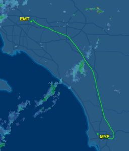 We flew for an hour, and then about 20 miles away from MYF, the controller started giving me vectors to gradually turn me around and line up with the ILS (Instrument Landing System). At right is the actual ground track from our flight. That bump out to the east near MYF is the result of those gradually turning vectors.
His vectors made us skip over most of the standard approach segments, which was confusing enough, and then he was giving us altitudes also seemed lower than the specified approach (but maybe that is fine?). Once on the ILS, things got better: you line up with a radio beacon coming from the airport and then keep it centered, horizontally and vertically, to end up right at the airport.
At about 700′ off the ground, David let me take off the hood — and I saw RUNWAY in front of me! I had a very nice landing and then taxied to the transient parking area. We shut down the plane and then too a Lyft to the SoCal TRACON center. The tour was excellent! Here’s what the control room looks like (with no people inside):

They let us sit at the controls in a training room:
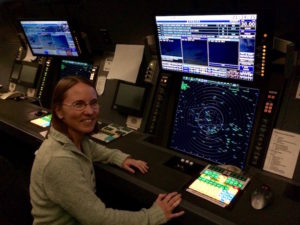
And then we took a Lyft back to the airport for our return flight.
Since I was wearing a hood while flying, I couldn’t look outside the plane nor take any pictures. So I took pictures on the way back instead :)
Here is a residential area not far from MYF, soon after taking off:
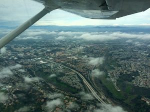
Here we crossed out over the coast:
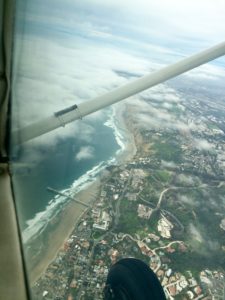
The clouds grew thicker beneath us:
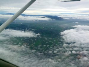
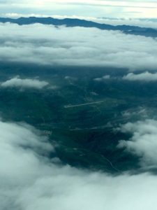
In a break in the clouds, I spotted a little runway! We weren’t going there, but it’s always nice to spot nearby emergency options.
And finally, we made it back to El Monte! Very eventful and exciting day.