Flying to Catalina Island
April 27th, 2016 at 11:57 pm (Flying)
Recently I had the opportunity to fly from El Monte to Catalina Island (KAVX). This is one of two local airports for which our club requires that you first go with an instructor, due to special challenges. (The other airport is Big Bear, KL35). Catalina is a beautiful island not far off the coast (~30 nm) that is 88% controlled by the Catalina Conservancy. The airport is privately owned and, unlike most of the L.A.-area airports, charges a landing fee ($25).
Getting from El Monte to Catalina poses the following challenges:
- Navigate around the LAX class Bravo airspace. (Flight following is your friend! Except when they are too busy.)
- Cross over the water. Bring life jackets. Study ditching procedures. Try not to freak out with imagined scenarios.
- Land on what looks like a misplaced chunk of runway stuck on top of a mountain. Don’t get low on final approach and crash like this Cessna 172 did, 9 days before our visit. The tail of the airplane is sitting near the west end of the runway (moved there from the crash site) – a grim reminder to take this seriously. Be ready to go around.
My instructor, David Werntz, wrote up an excellent guide to help you prepare for flying to Catalina. He’s not kidding about the poor runway condition! It’s not just bumpy, but it’s full of holes and little piles of debris. It looks like someone took a pickaxe to it all along the length. It definitely calls for soft-field takeoff technique to save your nosewheel. (Maybe soft-field landing as well!) Even better, the runway is peaked in the middle, so you take off (and land) on a 2-degree slope, which believe me does noticeable things to a Cessna’s acceleration. It also gives this awful illusion from the ground that the runway is going to end halfway along its length, since you can’t see over the peak during takeoff.
The trip out went smoothly. We aimed for Fullerton and climbed to 3500′, staying under the 4000′ LAX Bravo. At Fullerton, we turned southwest and climbed to 4500′ and headed out to sea. I could tell whenever my instructor got bored, because he’d ask, “Okay, where would you land if the engine quit … NOW?” When we got far enough away from land to preclude gliding back, he’d point out ships in the water to land nearby to minimize rescue time. “Ferries are good; they’re maneuverable and they have rescue boats,” he said. “Sailboats are bad.”
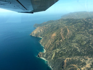
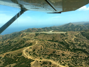
There it is, KAVX!
We flew to Two Harbors, then turned south to enter the pattern for runway 22. Delightfully, the airport was nearly deserted. I understand that on weekends it can get very busy. I got to do three landings (full stop), and we had lunch at the cafe.
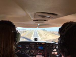
This view obscures the cliff below us. But steady on!
Unfortunately, we ended up with insufficient time for Manuel to get his three landings in! But thankfully, he flew us back home.
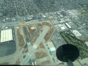
Crossing over Long Beach airport. Note the big red X on runway 16R.
Don’t land there!
That was a far more challenging transit than on the way out. The first SoCal approach controller he hailed refused to give us flight following (too busy). A controller on a different frequency was willing to take us, and after a few comments to Southwest XXX and Delta YYY, he spent the rest of our flight (transiting under the Bravo) devoted just to us. For some reason, we had constant traffic alerts, one after another, mostly helicopters. Coming in to El Monte, the controller directed us to make a right 360 for spacing (someone ahead of us), and then seemed to forget we were there. After prompting, he told us to make left traffic for runway 19. Suddenly, Manuel spotted a helicopter at our altitude just ahead, and called it out to the tower controller, who seemed a bit befuddled. He cleared us to land behind a Diamondstar, so we had to turn inside the helicopter, which was further out and moving slower. It all worked out, but it was the closest I’d been to a helicopter in the air. Go Manuel!
Here’s our route:
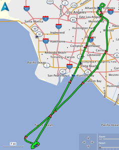
Given that trip, I am now certified by the club to fly their planes to Catalina. I’m thinking I could use some more practice there though! We might go out to do it again and let Manuel get his landings in :)
Here’s my updated map of L.A. airports I’ve visited since getting my license (green) and those yet to be visited (red):
