Flying to Oceano, by the beach

Today I flew to a little airport north of Los Angeles that is right by the beach – Oceano County airport (L52). There was some uncertainty in the morning as to whether the weather would be suitable; the marine layer was hanging out along the coast, and at 7:30 a.m. I got this alert for Airmet Sierra (IFR and mountain obscuration — basically means CLOUDS and “VFR not recommended”).
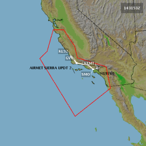
Airmet Sierra

However, I waited until the updated TAFs (Terminal Area Forecasts) came out at 10 a.m., and they were favorable – the clouds had dissipated at many locations along the route and were expected to continue to improve. I took off from El Monte and flew to Santa Monica, where I picked up Manuel. We then took off for Oceano, with me piloting and Manuel handling comm. For this takeoff, I got a “line up and wait” instruction for the first time! I rolled onto the runway and readied myself to stop and sit there, but then the controller cleared me for takeoff before I’d quite stopped so I went full throttle and took off.

We’d planned to get flight following to Oceano at an altitude of 6500′. However, when we made that request, the SoCal controller was too busy and told us to try back later. He then started chewing out some unfortunate pilot who was flying IFR but apparently wasn’t adhering to her assigned altitude and/or heading. Another VFR pilot called in with a flight following request and was also denied. Eventually we switched to another frequency and got someone who was less busy. Having ADS-B in the cockpit (which plots nearby planes on the GPS display) is great as a source of additional information, especially when the controllers are too busy!

Here is a shot of the beautiful coastline as we headed northwest:
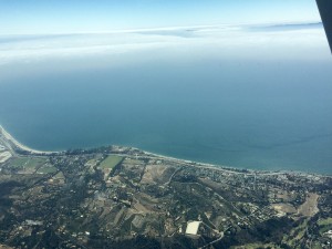
Coast

It took us an hour and 20 minutes from SMO to Oceano. It was smooth and uneventful. Near the end of the flight, we went right over the Santa Maria (SMX) airport, which was one of the stops on my long solo cross-country flight as a student pilot last year. It was fun to be going a bit further and to a new destination!

Oceano is a tiny airport, with a runway that is only 2300 feet long. That is plenty of space to land a Cessna 172, but it’s also important to be ready to go around if anything delays the landing. The most likely runway in use (given the weather reported at the nearest stations) was runway 29. We were coming from the southeast, which set us up almost perfectly for a straight-in approach. But for an untowered airport, it’s better to approach with a regular downwind entry so you have more time to scout out the runway (and any traffic). So I swung to the west and came up along the beach, then entered downwind for 29 on the 45. No one else was there. I treated it like a short field landing and came in steeply with full flaps. I didn’t land right at the start of the runway; I think I’ve gotten so used to El Monte’s displaced threshold that I feel uncomfortable aiming for the dirt before the runway. But of course, the plane always floats and it’s probably perfectly fine to do so. Still, I had plenty of runway; I didn’t even use up half of it. It wasn’t my best landing as the plane was swinging a little left and right (wind, I assume) and I touched down not quite aligned. I think I should have added power to delay touching until we were fully straight. But this was minor and the landing was safe and controlled.

Here’s the view on final approach to runway 29!
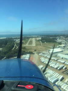
Oceano runway 29

We parked and decided to go get some lunch. This biplane was running its engine nearby (coughing and sputtering, poor thing). Someday it would be fun to go for a ride in an open cockpit! The airport also has bikes you can borrow to get around and a campsite!
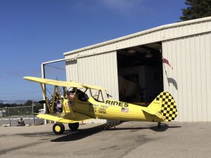
Biplane

We walked 3 blocks to the Rock & Roll diner, which is converted from two old train cars! It is charming and fun. :) It serves diner fare, BBQ ribs, Greek food (?), and Mexican food.
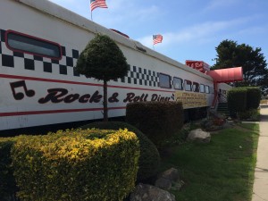
Rock n roll diner

We returned to the airport, added fuel to the plane, and then got ready to leave. The clouds were rolling back in. Vandenberg airport was reporting IFR conditions, although Santa Maria and San Luis Obispo (our closest weather-reporting airports) were still clear. We watched the noisy biplane take off, and I think he may have had a paying customer, because he was dipping his wings in crazy maneuvers before even clearing the runway! I’m not sure I want to go flying with him!

Manuel was the pilot for our return to SMO, with me on comm. That meant I had more opportunities to enjoy the view. I took pictures of all of the airports we flew over and also a nice shot of clouds off to the side and below:
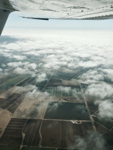
vista

For most of our flight, though, it was clear skies. Manuel took us on a more coastal route than I had used on the outbound trip. Here is Point Dume:
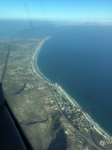
Point Dume

As we approached SMO, we observed that there were some clouds in that area. We kept a careful eye on them and decided it was acceptable for a VFR approach. Manuel made a very nice landing on runway 21! He hopped out and I started back up to return to EMT before the clouds thickened. 25 minutes later, I was back at El Monte! What a great flying day!

Flying to Santa Monica and Hawthorne… and over LAX!

Happy National Aviation Day!

I got to commemorate this day by visiting two new airports. My first stop was the Santa Monica airport (SMO). First I did a bunch of research on the SMO website. I appreciate the amount of information available, but this airport has so many rules and dire warnings (including written warnings and fines) that it is rather intimidating to plan your first flight there. They have specific procedures that include the following instruction:

“Maintain pattern altitude or above as long as practical. Approach as steeply as is safe and aim for a point further down the runway if your aircraft is capable.”

That is, they would like you to start high, land steep, and go long… all things one generally tries to avoid.

At any rate, I took off from El Monte and got flight following to SMO at 2300′. I had my GPS set with a direct route to SMO, but from my pre-flight planning I also knew that all I needed to do was follow the 10 freeway and stay under the LAX Bravo airspace (starts at 2500′). I kept it at 2300′ and was mindful of my heading. I didn’t encounter any other traffic, and it was a nice ~25-minute flight to SMO. I flew right between downtown L.A. on my left, and Dodger Stadium on my right:

Downtown LA Dodger Stadium

While 2300′ is still at least 2000′ feet above the ground, boy, it feels low when you are flying over the city! (I did not fly over the skyscrapers.)

I got a straight-in approach to runway 21 at SMO. It is a big, wide runway! I landed and discovered that they don’t have many painted taxiway exits. Instead you can exit the runway wherever it is paved. I got off the runway (I thought). It turns out that the huge asphalt expanse is still part of the movement area so you have to keep going and get on the taxiway itself before you’re officially clear of the runway. The controller prodded me and I got myself onto the taxiway. After I parked, I noticed several other arriving planes hesitate in the same way and then have to be urged to keep going. :)

A woman with two small children was watching planes land from the observing deck which is right next to transient parking. She was so thrilled that I had parked next to them (I guess because they could see a plane up close?) and wanted to know if I did it for their benefit!

I picked up Manuel and we took off, now headed for the Hawthorne airport (HHR). What lies between SMO and HHR is a really big airport called LAX. LAX offers a couple of ways that small planes can cross over it at low altitudes. The one we decided to use is called the “mini route”. I had flown it once before with my instructor (and my mom), but not as a licensed pilot! All the responsibility for an accurate and safe flight was on me.

SMO has strict instructions for how you depart it on runway 21: you take off, then at the end of the runway you turn 10 degrees to the left to get over a golf course, then turn to heading 225 to head out to the beach. You are not allowed to turn left before Lincoln Ave and you’re not allowed to turn right before the shore. We flew out over the beach and then kept climbing in a right turn to get us up to 2500′. I had plugged in the SMO VOR so we could fly precisely the right heading, 128 degrees straight at LAX. SMO handed us over to LAX and then I got to read back LAX’s magic words: “Cleared into class Bravo, maintain 2500.” We flew over all of LAX’s runways and planes and terminals, and then we were out the other side of the Bravo airspace. LAX handed us over to HHR, and I started descending (Hawthorne is RIGHT NEXT to LAX).

2016-08-19-laxI landed at HHR (my first time there too! It’s also a nice wide runway!) and we switched seats. Manuel took off and flew us to the Palos Verdes practice area and did some very nice steep turns. Then he took us in to the Torrance airport (TOA) which I also had never been to. Then we took off again and headed back north to SMO. That meant traversing the LAX mini route a second time, this time with Manuel at the controls. Because it’s the same altitude in both directions, it’s like a one-lane tunnel; you don’t get cleared in if someone else is coming in the other direction. (You can however get cleared in behind someone else going the same direction. There are rules for how to pass if you’re going faster than the plane in front of you.)

The picture at right is the view looking down on LAX as we crossed over northbound!

Manuel landed the plane at SMO. Unlike most airports in the area, SMO charges a landing fee, which will probably be two landing fees since we landed twice in that plane. I tried to find a way to pay it there, but apparently it will be auto-billed at some later point. Huh.

I flew back to El Monte (EMT) solo. Again I got to take off, fly over the golf course, head to the beach, and turn before heading back east. The SMO tower was giving flight following to EMT for two other planes, so he added me to his list; I never switched to SoCal. I also never got any traffic alerts – hopefully because there was no traffic :) Around downtown the SMO controller told me to contact EMT, who told me to make right traffic for 19. This was the first time I’ve approached EMT from the southwest and it was great! I made a precise 45-degree entry to the downwind, and I was cleared #3 for the runway. Uneventful landing and I was done! Fantastic day!

Flying to Agua Dulce

On the 4th of July, Manuel suggested flying out to Agua Dulce, a little airport nestled in the San Gabriel Mountains (elevation 2660′ MSL). I’d flown over it a few times in transit to other places, but this was my first chance to land there.

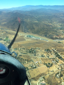
Agua DulceManuel flew out, with me handling comm. We got flight following at 6500′, which meant cresting just over the mountains and then descending. As we got close, SoCal suddenly told us that “runways 22 and 4 are closed at Agua Dulce” which are, of course, its only runways. Manuel decided to overfly it anyway. We got right over it and SoCal said that the closure actually would start the next day, so we were able to land. Unicom was deserted, but we could see the windsocks and runway 22 seemed appropriate, so Manuel did a teardrop and came in to land on 22. At right is the view you have entering on the 45 for 22.

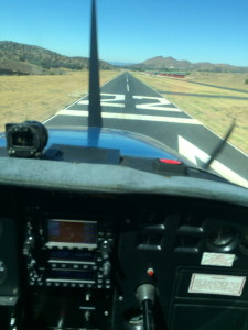
Agua Dulce runway 22It’s a bit of a hairy approach. There is rising terrain to the northeast as you prepare for your base turn, so you’re flying right at the hills while judging your altitude and distance from the runway (although it isn’t nearly as bad as Flabob). Coming in steep is a help, and a smooth 180-turn descent is probably more appropriate than a regular rectangular pattern. Then you’re on final and whoa, this runway is NARROW! As you can see, the numbers barely fit! There is also a significant downhill grade which feels very odd when you take off.

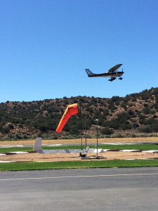
Plane at Agua DulceThe airport and runway are very nicely maintained, aside from the lack of taxiway markings from the runway (they can zip past before you notice them if you aren’t prepared!). The hangars are a beautiful deep red color. I found out later that it was to be closed for filming, and I can see why. While we were there, another plane fueled up and then took off. It was very shiny (aluminum?). You can also see a beautifully vivid windsock (one of three) and a wind tee on the ground (that’s the segmented circle).

We swapped seats and I did a loop around the pattern for practice. I went much too wide trying to avoid the hills to the northwest; a tighter pattern would allow you to come in before the hills and be immediately on (tight) downwind for 22. I landed, got off, and then taxied back, and took off to depart to the southwest (honoring their noise abatement request for 10-deg right turn after takeoff – although that heads you to the hills so it feels awkward). I flew back at 5500′, going around the mountains so a bit less direct than Manuel’s trip out. Manuel handled comm for me. It’s nice to team-fly; it allows you to focus more on flying the plane!

This plane just got some new avionics (ADS-B transponder) which among other things gives you traffic information on the GPS screen. On the way back to El Monte, I was just about to begin my descent when I noticed a plane seemingly heading straight towards us but 700′ below. The EMT tower announced the traffic to us, and we scanned for it but couldn’t find it. (Air quality is still poor from the recent fires, and there’s a lot of haze.) I delayed my descent to stay well above it. Then we got an audible warning from the avionics about this traffic! That was kind of cool. We finally spotted it ahead and off to the left, below us, and then I was able to descend.

Since we were a bit high on final, I got down to idle (still high) and went into a slip. Just a few seconds later we were on the glideslope so I came back out of the slip and proceeded with a short-field landing (full flaps). Yes, the flaps would have been enough to get me down as well, but it was a good chance to practice slips (it’s been a while!).

I’m up to 12 L.A. area airports now. Many more to go!

Flying to Flabob with a friend!

Today I got to fly with another pilot, Sara. We’ve been trying to get out to Hemet-Ryan for weeks, but the weather just won’t cooperate. Yet again, today, the clouds were too low to make that possible. However, we were able to fly out to Flabob (KRIR) and Corona (KAJO).

I took the helm to fly us out to Flabob. The ceiling was reported around 3500-4600 AGL, but when we got up it seemed a bit lower than that. I settled on 2800′ MSL. SoCal directed us around some traffic, and we got a smattering of rain, but we had a nice view while flying east.

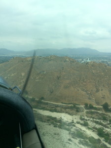
Mt. RubidouxFlabob is certainly a challenging place to land. There’s a big hill/mountain (Mount Rubidoux) that squats just southeast of the runway, right about where you want to be when you’re getting ready to land on runway 24. This biases you towards turning (left) base a bit early. I ended up coming in high on my first attempt to land and doing a go-around. The second time worked out fine, but it takes some mental effort to intentionally fly at a mountain at 80 mph. When it was Sara’s turn, she figured out that by flying a diagonal base leg you can avoid the mountain yet still get a longer, more normal final approach. Brilliant!

At Flabob, we stopped and switched pilots. Sara got in, did a loop around the pattern, and then flew us to Corona. We got a transition through Riverside’s airspace and then cruised over to Corona, whose runway is the same length as Flabob’s but in rather nicer condition, and much wider. There are some beautiful marshlands north of Corona where birds nest.

AJO marshlandAfter landing at Corona, Sara took off again and we got a transition from Chino airport and then flight following to head back to El Monte. Spotting El Monte was difficult due to the low clouds and grey sky, but we got in just fine. Overall, several great landings by Sara!

It was really great to fly with another pilot! We helped each other out with radio communications, double-checking frequencies, and discussing airport approach strategies. Sara has a lot more experience than I do, and I can learn a lot from her (already got some great tips)!

Below is the track of our flight, starting from El Monte on the left and heading to Flabob (KRIR), then Corona (KAJO), then back to El Monte.

RIR - AJO - route

That makes 9 out of 26 L.A. airports for me!

Flying to Redlands

The weather briefing for my flight today had an unusual feature: an upcoming TFR (Temporary Flight Restriction) over my destination, the Redlands airport. It seems that Redlands is hosting an airshow this weekend, and in addition to the TFR covering the airshow itself, they blocked out an hour today from 3 to 4 p.m., possibly for the airshow pilots to practice.

Some calculations later, I determined that I should be able to get to the airport, pre-flight my plane, and fly to Redlands and back before the TFR kicked in. I was off!

(Why Redlands? It’s one of the five airports in the upcoming Flabob Poker Run. I’m doing advance scouting!)

Santa Fe Dam
I got flight following from El Monte and climbed to 5500′ to head east to Redlands. This is not a picture of Redlands. It’s a picture of the Santa Fe Dam area, which I flew past. It’s pretty awesome – note the stepped dams on the left to block debris flows from the canyon. Plus, golf course. I stayed north of the 210 freeway, then swung down behind the San Bernardino airport to enter the right pattern for runway 26 on the 45.

As I was about to turn base, I noticed a helicopter about to land. A few seconds later, someone on the radio said “All aircraft, use the radio for safety” which may or may not have been directed at the helicopter. I had been announcing my position, but hadn’t heard anything from a helicopter. I gave it some extra time and by the time I turned final, it was already out of sight.

On the ground, it was pretty busy at Redlands, with carts, trucks, and planes moving around in preparation for the airshow. I spotted a very pretty red biplane! But it was already 2:30 p.m. and I wanted to be sure to be out of there before the TFR kicked in at 3. I took off back to the west, turned sharply north to stay out of San Bernardino’s airspace, and got flight following back to El Monte at 4500′. It was fun cruising through Ontario’s airspace!

Here is my route today. The more northerly track was me headed east to Redlands, and the southerly one is me coming back.

Redlands route

Back at El Monte, I still had energy and time left, so I did some pattern work. I worked on my left traffic patterns, which tend to be weak (we’re used to right traffic at El Monte, and also at Redlands!). I worked on improving my base to final turn. I also made two very nice short-field landings despite the wind, which was gusting from 8 to 14 knots and also swinging around between 170 and 220 degrees. Great flying day!

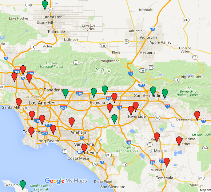
Here is my updated airport map. I’ve now been to 8 of 26 L.A. airports since getting my license!

2016-05-13-airport-map

« Newer entries · Older entries »