Flying to Santa Barbara

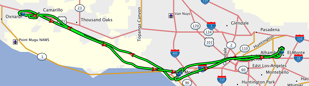
Recently I flew to Santa Barbara (KSBA), my first class C airport! The seasonal Santa Ana winds were in effect, so I got to use weird runways for part of the trip.

1. From El Monte (KEMT) to Santa Monica (KSMO):
Normally our wind is from the south, and we typically use RW 19. On this morning, the winds were from 050 at 7 kts, and RW 1 was in use. The Santa Anas come from the desert, and sure enough – the temperature spread indicated a relative humidity of just 15% (dewpoint was -9 C!).

Departing on RW 1 makes my home airport feel like an alien airport. I made a left downwind departure for Santa Monica (that’s how backwards it was). Halfway there, near Dodger Stadium, I was given a vector to avoid a 737 (probably on downwind for LAX). I never saw it, so it was probably pretty far away and above me (in the LAX Bravo airspace, which I was studiously staying under). But I’m happy to get out of their way anytime 😃

KSMO told me to make left traffic for RW 3 (also not the usual runway there, and humidity was down to 9%!). I was following a small jet, so I also got “caution: wake turbulence.” It was flying a higher, wider pattern (at a higher speed as well) so it was a bit weird to be below and between it and the runway, but I kept it in sight without trouble. It landed just as I was abeam, so I had a great view of its touchdown point and was able to plan my landing accordingly. (When landing behind a jet, you want to touch down past where it did so its wake vortices don’t roll you onto your back.) I made a nice landing and taxied to the transient area to pick up Manuel.

2. From KSMO to Santa Barbara (KSBA):
Manuel took the helm, and we departed on RW 3. He was piloting and I was doing nav and comm. This is a great way to split piloting duties! Except I managed to say something like “Santa Monica Tower, Skyhawk 54678 holding short of runway 3. Requesting left crosswind departure to Santa Monica.” DOH. I meant Santa Barbara! Tower politely asked me to repeat my destination and I got it right. 😃

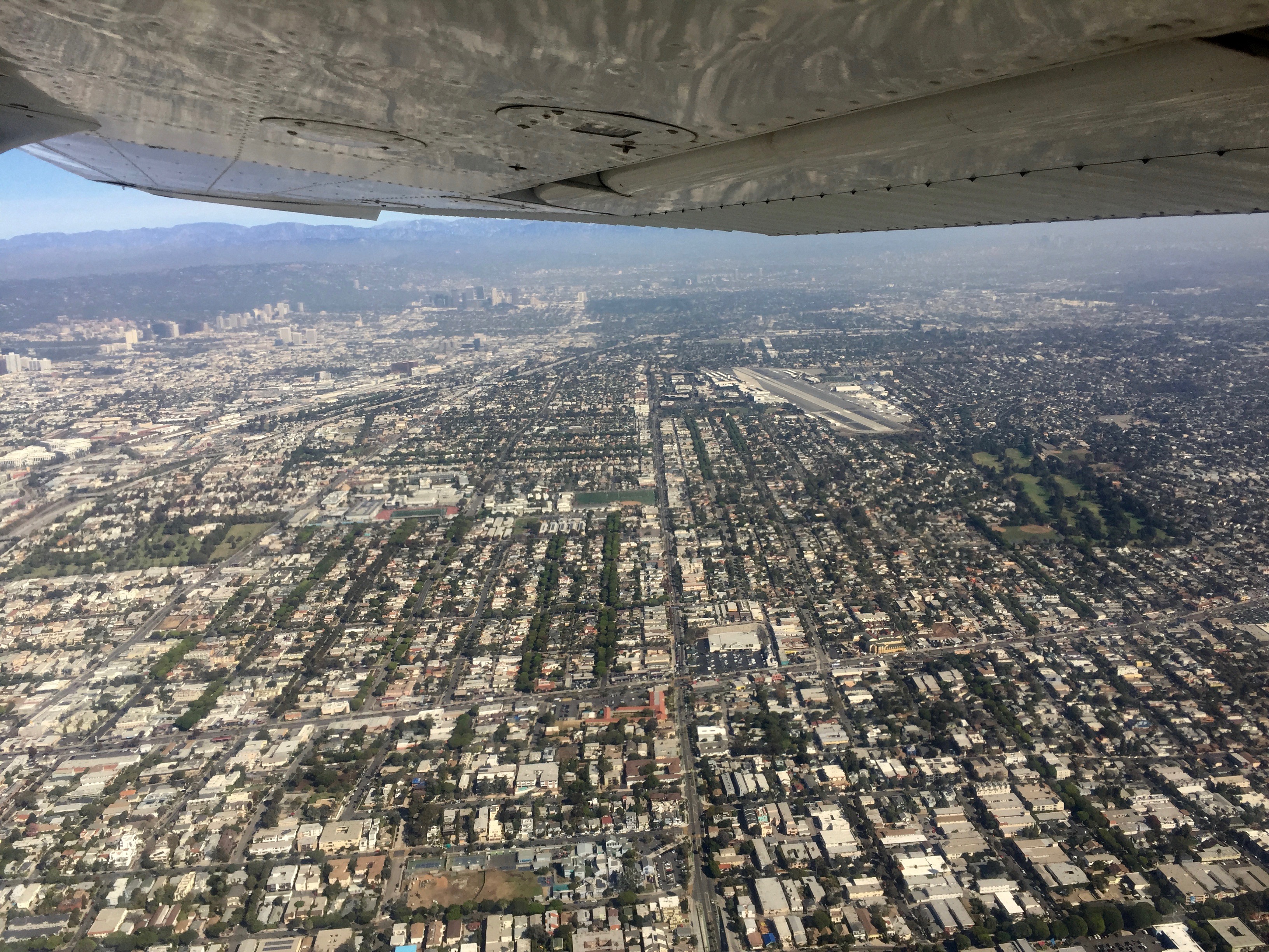
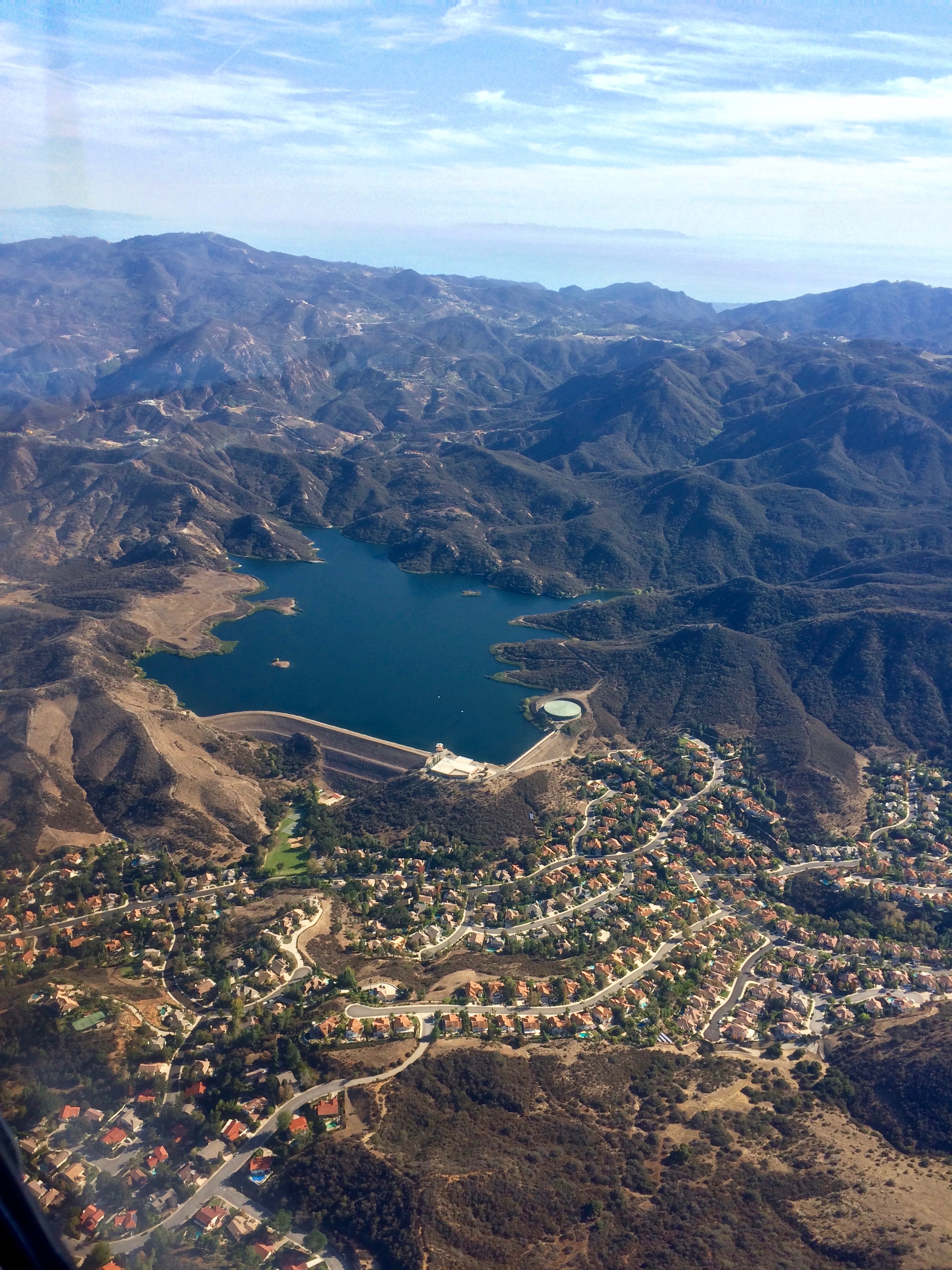
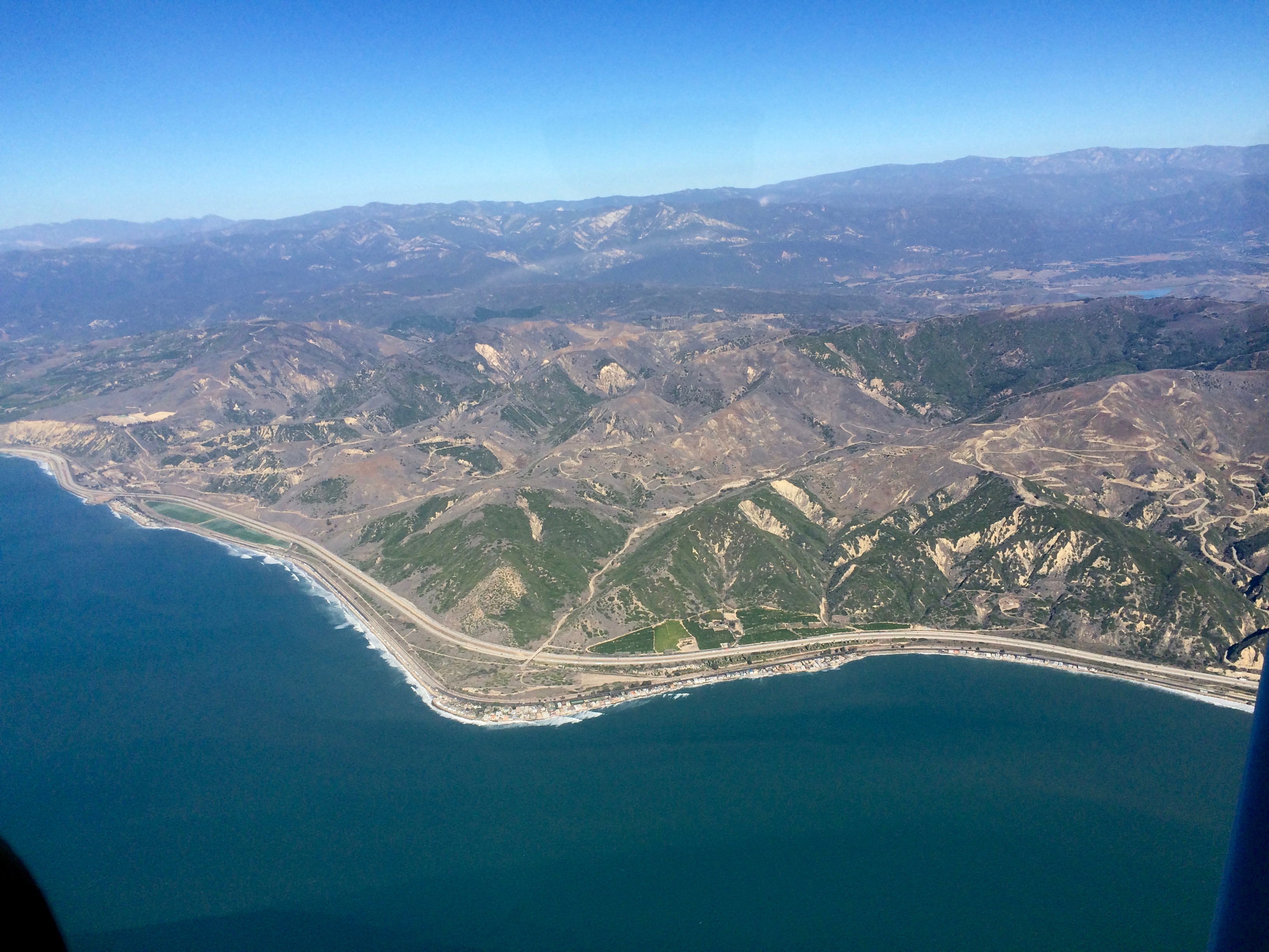
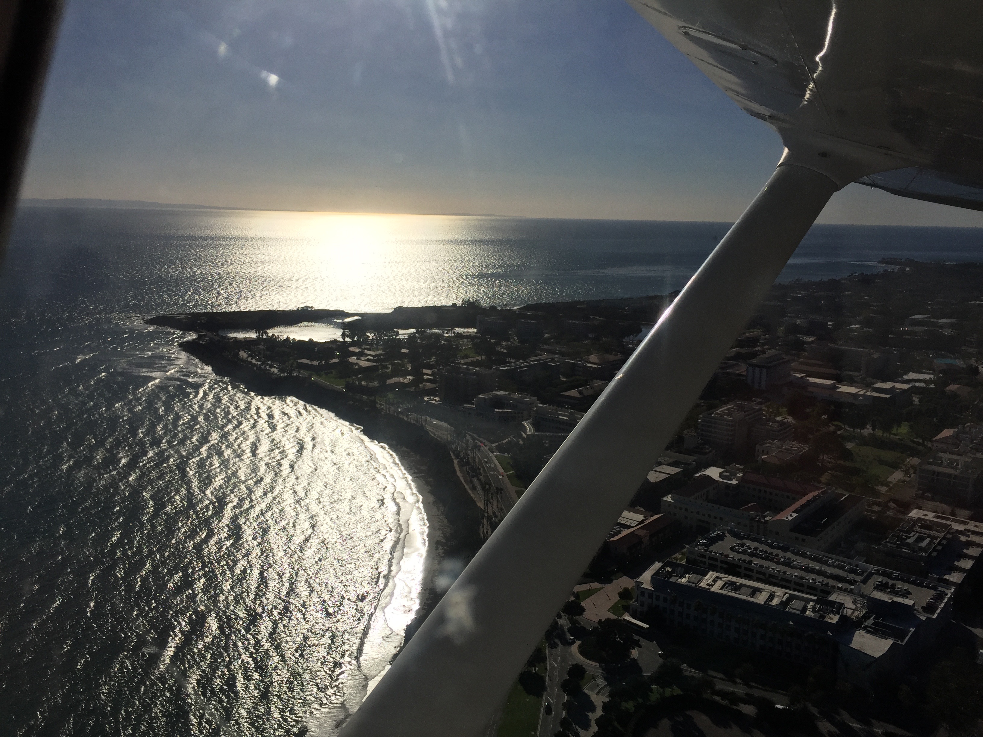
Manuel flew us along the coastline, which is stunning (although my pilot brain can’t quite relax due to contemplating the minimal emergency landing options). We also had a nice tailwind that had us making 130 kts ground speed!

2016-11-18-coast

When we got close, Santa Barbara Approach handed us off to the tower and that was it – we were inside class C airspace! It was kind of anticlimactic. KSBA was less busy than KCMA (class D). The only difference was that tower was giving us vectors, which actually makes your life easier. We landed on runway 15L and taxied to the Atlantic FBO. One difference was that we were told to “monitor” the ground frequency, not to “switch” to it, which apparently means “switch frequencies but don’t self-announce.” Tower had already given us taxi instructions, so we didn’t need more info from ground, but we would certainly want to be listening if they had anything more to say to us (they didn’t).

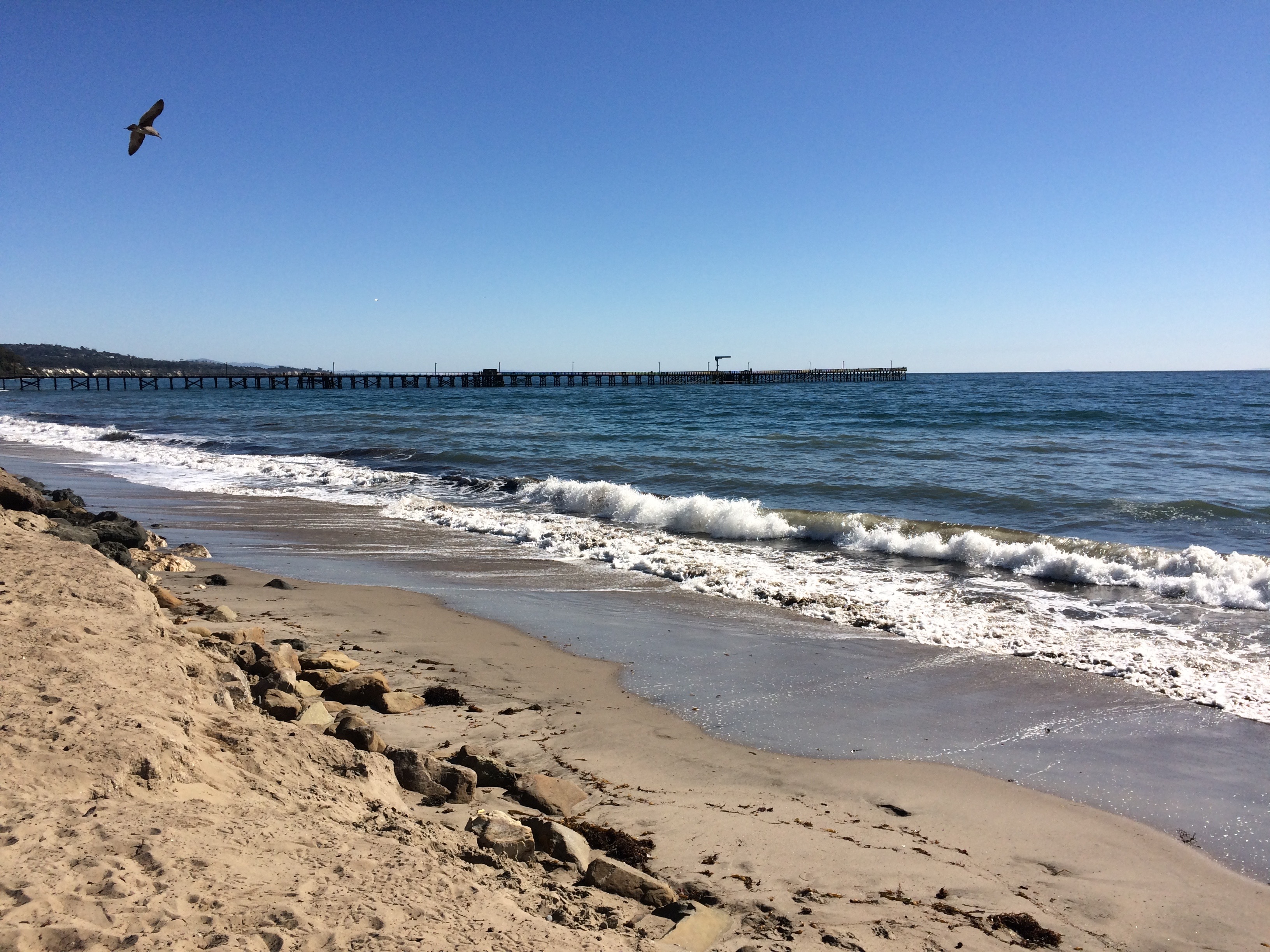
We signed in at the FBO and then walked down to the beach! There is a nice 10-15 minute walk to Goleta Pier and a cafe right there. Perfect lunch spot!

2016-11-18-goleta-beach

3. From KSBA to KSMO:
After lunch, I flew us back. A class C airport requires that you first call “clearance delivery” to make your departure request. The key pieces of information you need are summarized by the acronym “CRAFT”:

  • C: Clearance (e.g., if it’s a named procedure, or your destination)
  • R: Route (direction)
  • A: Altitude
  • F: Frequency (of departure control)
  • T: Transponder (squawk code)

We were assigned runway 15L, the same one we’d landed on. Except that the winds were now from 320 at 3 kts. I stared at that for a minute before saying, “That’s a tailwind,” in puzzlement. Manuel noted that they don’t like you to take off to the north since there is a big mountain right there. So… okay… 3-kt tailwind… but more runway than we really need, so I guess that’s okay…

[Note: that uneasy feeling is a sign that you should probably check your personal minimums and decide whether you want to proceed. This is something I am still working on. Curiously, “tailwind component” is not on the list (only “crosswind component”).]

There was also a warning for “low-level wind shear”, which is NOT a pilot’s friend. As we taxied into position, I kept glancing at the wind sock, which was swinging around. Tower announced that the wind was now from 090 at 7 kts, which was stronger, but I’d rather have that crosswind than a tailwind.

While we waited, I heard another plane being cleared to take off on runway 7 (KSBA has crossing runways). That would be a much better runway, given the winds, but maybe they only use that one for commercial traffic. Anyway, we finally got cleared to take off and “maintain runway heading.”

This makes for a breathtaking soaring climb out over the ocean. We were initially told to stay at or below 1800′, but before we reached that altitude, they canceled the restriction. I kept the heading nailed, but after a while of climbing into the big blue sky I rather wanted to turn and head for Santa Monica (and get back closer to land). Tower kept us heading out for what seemed like a really long time (we got to about 5000′) before allowing us to turn.

2016-11-18-sba-takeoff

Since we hadn’t actually asked for “flight following”, I wondered how that would work out. We had a squawk code, but in some online discussions I’ve seen cases where towers assign local codes that aren’t valid once you leave that airspace. But tower handed us off to departure, and departure to Mugu, then SoCal approach, and a couple of times we got traffic warnings, so it all seemed to work perfectly.

That same wind that had sped us over to KSBA fought against us on the way back. I had trouble getting the plane up to 100 kts ground speed (despite 120 kts indicated).

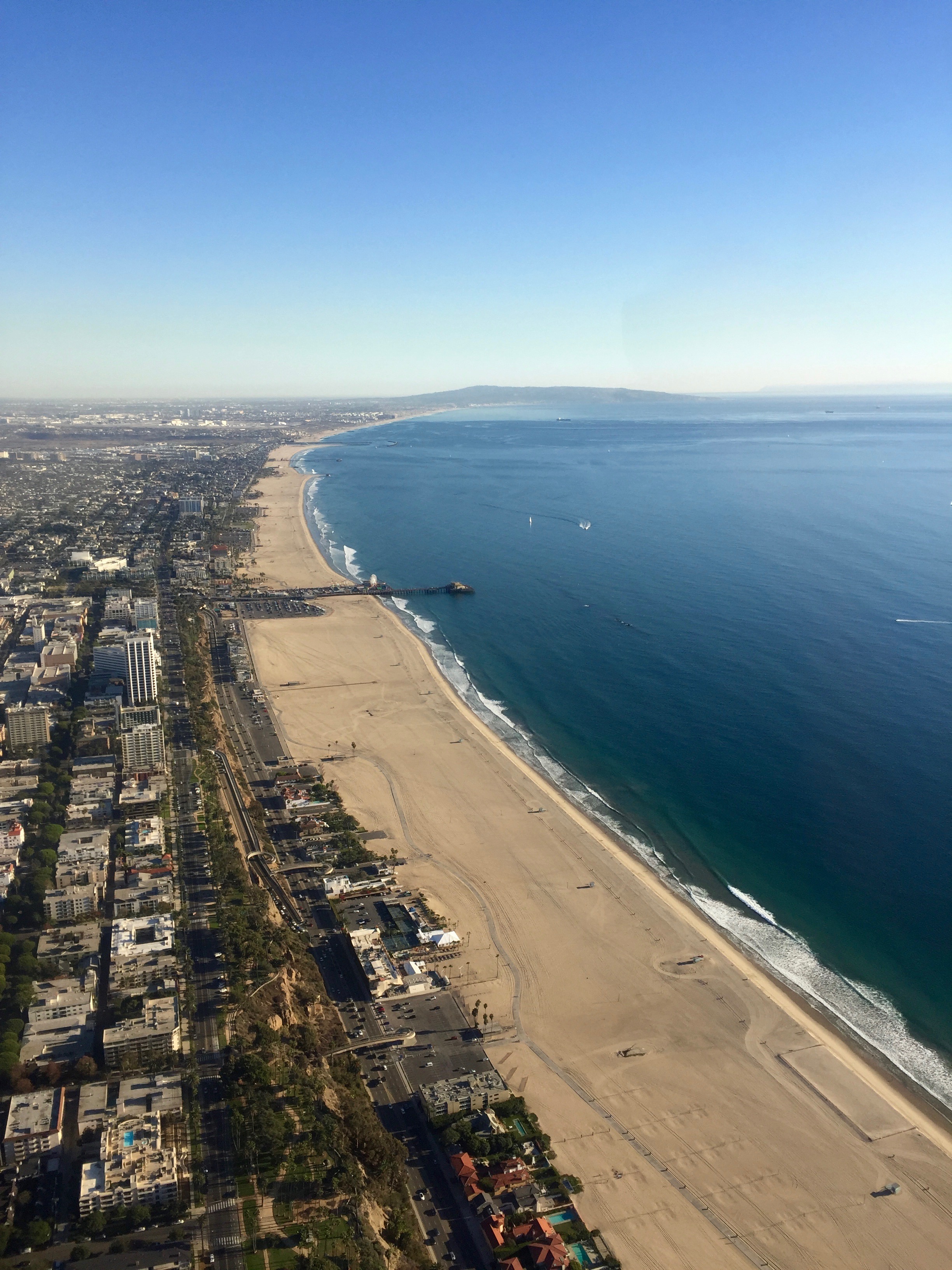
Santa Monica beach and pier:

2016-11-18-sm-pier

I got a right downwind approach to runway 21 at KSMO along with a request to “keep it tight” (someone else coming in). The approach and set-up were all fine, but at the last minute I tried to fix the sun visor (we were landing right into the sun and I don’t have sunglasses) and I think that threw me off a little – a bit of a clunk! Lesson learned: don’t mess with stuff when you’re 20 feet off the ground, even when it seems trivially easy 😃 (Yes, I already knew that. But sometimes experiencing it really shows you why!)

4. KSMO to KEMT:
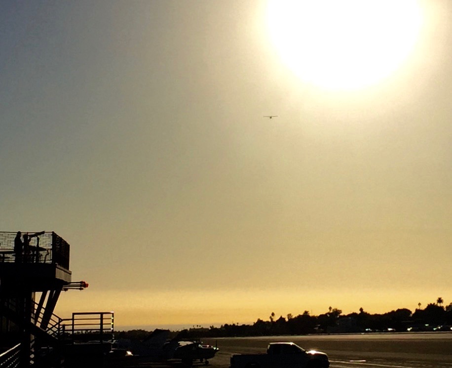
After dropping Manuel off, I taxied up to take off of RW 21 for return to KEMT. I was #5 in line waiting! I got to watch a Decathlon take off (cute little tailwheel!). Then I was off and turning into a left downwind departure. Manuel got this great shot of my takeoff, including people on the observing deck.

2016-11-18-ksmo-sunset

Despite my request, I never did get flight following set up by the KSMO folks, but it’s such a short flight that I just kept my eyes peeled, stayed under the Bravo, and switched over to KEMT when I was downtown. I got a nice normal right traffic entry to RW 19 and a very nice landing near sunset. Done!

Training as a WASP for WWII

I recently read a charming book by Bernice (“Bee”) Falk Haydu. She was a member of the WASP (Women Airforce Service Pilots) program in WWII.

It’s delightful to follow along with her training. Before being accepted into the WASP program, Bee learned to fly in a Taylorcraft. As a WASP (starting in 1944), she learned to fly a Stearman PT-17 (“PT” for “primary trainer”), which had an open cockpit, no radio, and a 220-hp engine:


The instructor sat in front and spoke through a funnel into the student’s ear. The student couldn’t talk back to the instructor.

After a couple of months, she moved up to a Beechcraft AT-6, with a closed canopy, lots of instruments, and a 650-hp engine. Quite an upgrade in capability and complexity!

She also used a simulator on the ground called a Link trainer, for use when the weather was too poor to fly outside or to practice instrument and night flying. The hood could be closed to block out all light.

Her training was intense. She spent half of her day in ground school and half flying. She went through several check rides to demonstrate her ability to fly each plane. She received instrument training. She had to demonstrate proficiency with Morse code. She did a *2000-mile* cross-country flight, not as a special race or endurance test, but as part of her training (today you count anything over 50 miles as “cross-country”!).

On her first solo cross-country flight, she had engine trouble (her right magneto failed) and had to do an emergency landing. She describes it as “really fun, nothing serious.” I would have been terrified!

Her flight log from a night cross-country flight would be familiar to any modern pilot! It has estimated and actual times for passing a series of check points along with compass heading, magnetic course, and ground speed. It’s annotated with her notes about the winds (used to compute some of those values). She talks about using an E6B, which is a circular slide rule that we still use today for quick calculations (like distance, speed, and fuel needed to reach a destination). Her flight log doesn’t include fuel information :)

In 1944, the VOR system (radio navigation) wasn’t yet widely available. I’m not sure what she used during the day for navigation (possibly just her eyes and landmarks), but for this night flight she describes the use of light beacons which were spaced out every 10 miles and would flash a one-letter Morse code. By decoding the Morse letter, you could figure out where you were. (VOR stations also use Morse code – audible instead of visible – and pilots can listen to confirm they’re tuned to the one they want. But with the availability of GPS, VOR is more of a backup system, and we are no longer required to learn Morse code.)

Bee was a member of one of the last WASP classes to graduate. She was posted to the Pecos Air Force Base, where she was to spend only three months before the WASP program was disbanded in December, 1944. However, she was determined to continue in aviation, and she became a ferry pilot for Cessna and then headed her own Cessna dealership, flying a demonstrator plane around to raise interest and sell planes. She also successfully led the campaign to get official government recognition for the women of the WASP program for their service to the country. She is now 95 years old.

Bee autographed my book. What an honor!

Flying to Camarillo

Today I flew to the Camarillo airport (CMA) for the first time. Here is the complete track. I started at El Monte (EMT) and flew to Santa Monica (SMO), picked up Manuel, and then flew to Camarillo (CMA). Manuel flew us back to SMO, and I flew myself back to EMT.

CMA track

When we departed SMO, I got a “line up and wait.” This is when you get onto the runway and sit there, waiting to be actually cleared to take off. This is like someone telling you, “Get on the freeway and then stop there until I say go.” Kind of nerve-wracking, but it is supposed to be a more efficient way to move traffic along.

Here is a shot looking back at SMO after we took off:

SMO

I’d been warned that CMA can get busy. And wow, it was! When we switched over to join the CMA tower frequency (about 10 miles out), the controller was going a mile a minute. Before we could get a word in edgewise, another pilot called in requesting clearance to land (N216RG). The controller told her that he was too busy and for her to remain outside the CMA airspace. When we called in, he allowed us in and told us to report a 4-mile final at 1500′. Being given an assigned altitude on final was new to me, but okay, I can do that. I think we were allowed in because we’d requested flight following in advance, so we were “in the system”. Or, maybe we were in a better location for him to accommodate us. The other pilot called in a couple more times but the controller kept telling her to circle outside the airspace. He even suggested that she go to Oxnard. She said, “But I’m going to Camarillo.” He said, “I know, but we’re just saturated here, if you’re short on fuel then go to Oxnard, or try again in five minutes or so.” Poor 216RG! I don’t know why she got the short end of the stick!

Meanwhile, two planes were on downwind and turning base for runway 26 as we were doing our straight-in approach. At first I couldn’t see either of them visually, although I could see them on my GPS screen (yay ADS-B). The controller worked to get them separated, and then we reported “4 miles out, 1500.” He then told us to stay at 1500′ (pattern altitude is 877′) and fly straight over the airport, reporting when we were over the numbers (landing threshold). So we’re flying in and watching this busy drama unfold underneath and around us.

When we were over the numbers, the controller thanked us for our patience and told us we could turn left, descend to pattern altitude, and follow a different plane that was on final below and behind us. I guess that’s what you do when there are too many planes coming in – stash one (us) above the airport and fit it in later! That was definitely the strangest (geometry-wise) approach to landing I’ve ever done. As we were landing, the controller finally let 216RG come in.

CMA runup areaCMA has many nice features. I noticed this one while doing my flight prep, which includes examining the airport with Google Maps’s satellite view (click to enlarge). Check it out! It’s a painted runup area with little stations for each plane and a dashed line to keep them out of the way of passing traffic! It’s BRILLIANT!

The runway itself is a generous 6000′ long, and it clearly used to be longer. According to Wikipedia, prior to 1970 it was the Oxnard Air Force Base and had an 8000′ runway.

CMA has a lot of transient parking, so it was easy to find a good spot. It also has a very nice restaurant (the Waypoint Cafe) which features a tiny mock airport outside, complete with tower, rotating beacon, runway, and helipads!

As we walked into the cafe, some other pilots joined us and everyone commented on how busy it was. They thought I was poor 216RG! (Because I am female, no doubt, and how could there be two female pilots there at the same time? :) )

After lunch, we started up again. Before we could leave, two helicopters came in and landed in front of us. They faced each other and slowly eased down, synchronized. Very cool!

Helicopters

Departing was rather challenging. We lined up and sat at the runway threshold for quite some time while several planes came in to land and a helicopter departed. It was like when you get stuck at an intersection and then the railroad lights start flashing and the bars go down and you know you’re going to have to sit through several cycles before you can move.

Finally we got to depart. We were grateful to get off that frequency and switch to SoCal for flight following! The flight back was uneventful and scenic. The southern California coast is a delight to fly along (but watch for those mountains).

Looking back at CMA after departing:

CMA - looking back

A lake on the way back (near Westlake Village. Google Maps doesn’t deign to give it a name):

CMA - lake

Trump and Clinton and general aviation

The Aircraft Owners and Pilots Association (AOPA) is one of my favorite organizations, mainly due to their intense dedication to ongoing education and pilot safety. They also do a lot of advocacy for the general aviation (GA) community.

This AOPA article provides a fascinating glimpse into the intersection of the current presidential election and GA:

Election 2016: Plane Politics

Wow, both Trump and Clinton have already spent millions of dollars to cover their campaign travels. Even more wow: it costs them “between $5,000 and $14,000 per flight hour” (!!). My brain boggles at this. I pay $105 per hour to fly a Cessna 172. You wouldn’t want to tour the country for a campaign in it, but still…

The biggest wow? To fly Air Force One, “the government places the price tag at $206,337 per flight hour.” (!!!) You could just buy a new plane every hour and have money to spare. (This figure includes security costs and presumably the staffing as a whole as well as the plane itself, fuel, etc.)

The article also reports on the results of several questions AOPA posed to both presidential candidates. Only one candidate replied. Guess which one?


Both candidates’ campaign planes

Fighting fire from the air

In late June, a forest fire came within a mile of my house. I stood outside transfixed, watching the firefighting planes dive and drop red fire retardant in a scarlet line on the hillside to keep the fire from reaching us. Truly awe-inspiring!

I’m now preparing to interview one of those pilots, for a course project. California’s state firefighting organization is CalFire, which employs helicopter pilots year-round and airplane pilots seasonally. CalFire has 23 Grumman S-2T airtankers that drop the fire retardant, and two of them are based nearby at the Hemet-Ryan Air Attack Base. You can browse California’s most recent fires.

This is not an easy job, and the qualifications are steep – 1500 hours of flying experience, 1200 of which as pilot in command. To pilot an airtanker, you must also have commercial, multi-engine, and instrument ratings. You have to be willing to fly low and slow, in steep terrain, with powerful winds and in the heat. Any one of those is a risk factor, and combining them all together makes for some of the most challenging flying out there.

Aerobatic pilot superstar Patty Wagstaff has also joined CalFire: she doesn’t fly the large airtankers but instead flies smaller tactical aircraft, in which she helps the flight supervisor monitor the fire and coordinate its response. Talk about precision ground reference maneuvers!

But the job is risky (pilots die), and the planes are expensive, and there is some debate about whether they are a cost-effective way to fight fires. Yet by now the public expects to see them out there on the front lines, and I can attest that it was very cheering to see them keeping that fire away from my home. (It is impossible to see all of the ground firefighters from the same distance, sadly!)

I’m very much looking forward to talking to one of these pilots in person! So many questions to ask. :)

« Newer entries · Older entries »