Flying to Twentynine Palms

On April 1, I took my friend Vali for her first flight in a Cessna 172. Vali is a geologist who does a lot of field work in the Joshua Tree area, so we decided to fly to the Twentynine Palms airport (KTNP) which would give us some great aerial views of places she already knows well from the ground.

This was a good chance for me to do some more flying outside of the L.A. Basin. I’ve been working on trying to visit all of the L.A. airports and have now visited 17 of 26 (!). But it’s good to get some longer flights in and more experience with new locations.
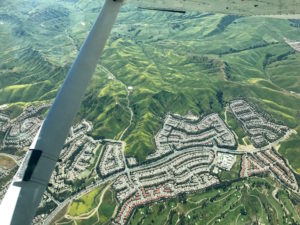

Chino Hills with spring green and yellow flower fields

Starting from El Monte, we flew southeast to the Paradise VOR (PDZ), then east through the Banning pass at 7500′. That’s high enough to have some options for landing, but still below the mountain peaks to the north and south, yielding some dramatic views.
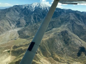

Mt. San Jacinto, south of the Banning Pass

We also got a good view of the San Andreas Fault, just east of Palm Springs.
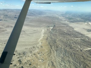

San Andreas Fault

We continued on to the Palm Springs VOR (PSP), then turned northeast to head to Twentynine Palms.

At TNP, we found a cute little pilot’s lounge stocked with water, sodas, and snacks (honor system to pay for fridge items). It also has a microwave and a bathroom. Great place to have our picnic lunch!
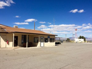

TNP pilot’s lounge

TNP has the largest and most visible wind tetrahedron I’ve ever seen. It looks like a huge yellow tent and easily spins around to show the current wind direction. Next to it, the windsock looks small and ineffective.
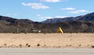

Windsock and wind tetrahedron at TNP

TNP has runway options for north-south or east-west winds. The larger and more improved runway runs east-west, but the winds at the time of our visit were coming from the north, so we took the smaller one. That meant flying downwind south straight at the rising terrain, then turning for a left base entry to runway 35. It’s 3800′ long, which is plenty, but only 50′ wide, compared to 5500′ x 75′ for the more commonly used runway 8/26.

We returned following highway 62 through the Morongo Valley and back west through the Banning Pass at 8500′. I tried to descend a few times as we got closer to the PDZ VOR, but SoCal kept me high to deconflict with traffic. You can see that we didn’t actually reach the VOR but instead did some navigation north around it – SoCal gave us vectors to avoid traffic during that period.

TNP track
Flight track (click to enlarge).

Both flights were great! We got to see some great terrain and to visit a new airport. It took us about 1.25 hours each way, with a headwind on the way east and a tailwind coming back. It wasn’t a crystal clear day, so there was some distant haze, but still good visibility. One annoyance was that there was light turbulence throughout, which makes the ride a bit less comfortable, but nothing problematic. We overheard someone else coming through the pass who was getting 1000 fpm up- and downdrafts, and we were glad not to have anything that wild!
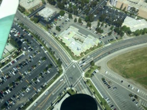
Flying to Torrance through the LAX Bravo

On Friday, I flew down to the Torrance (Zamperini Field, KTOA) airport – another new one for me!

I requested flight following at 3000′. Manuel handled the radio and, after we departed KEMT and switched to SoCal, he asked for a transition through the LAX Bravo! And we got it! “Cleared into class Bravo!”

There was an AIRMET out for moderate turbulence below 12,000 feet, and we definitely got a taste of light bumps throughout the half-hour flight. The plane felt frisky, bouncing up and down and making sudden waggles to one side or the other. I noticed that it took a lot of my attention to maintain altitude and heading – and since we were transitioning the Bravo, we were on assigned headings and altitudes for most of the time. That left less time for looking outside the airplane. Nothing bad happened, but I definitely noticed the increased workload.

KTOA has two tower frequencies, listed as “north” and “south.” We used the “north” one as we were coming from the north. My pre-flight research also turned up warnings about birds and farm equipment (!).

I got a right base entry to runway 29R. Winds were reported as 290 at 13 kts. I turned final right on the glideslope, but then had some trouble maintaining the glide as I had to keep adjusting power. The wind started moving around a bit and I dealt with a small crosswind on short final, and then we landed.

We taxied to the transient area and switched places. Manuel started up and I took the comm. In the time it took us to switch, the wind kicked up stronger from the south and now had a noticeable crosswind for runway 29R. While holding short, we watched the same plane make a series of poorly controlled crosswind touch-and-goes. But no worries, we had a master pilot at the controls! Manuel took off like a pro and we made a right downwind departure.


Looking down just after departure from KTOA on 29R.

This time I hailed SoCal and asked for the Bravo transition (at 3500′). And got it again! Two Bravos in one day! Well, the same one.

On the way back, the ride was noticeably smoother (and mostly tailwind). SoCal kept us busy spotting traffic.

Overall, it was a fun hop down to KTOA, which has a nice big runway (plus a smaller companion one to the south). It was also good to practice requesting a Bravo transition, which saved us time and, to my surprise, was apparently no big deal. And of course, we had a fall-back route we would fly if they said no. Next time I will have to try it solo!

Flying by instruments to San Diego

I’m not yet certified to fly in the clouds. But recently, events conspired to end up with me in the pilot’s seat, on a instrument flight plan, all the way to San Diego!

It was a rather last-minute decision. Manuel and I had planned to go to a tour of the SoCal TRACON facility in San Diego. These are the voices we hear over the radio that guide us around the southern California airspace and help us not run into other planes. Another pilot planned to take a second plane. But then it got too cloudy and stormy for us to fly, and the other pilot had a brilliant idea: invite an instructor (David) along, all pile in to one plane, and then make it into an IFR (Instrument Flight Rules) lesson!

We decided that I would fly the segment from El Monte (KEMT) to Montgomery Field (KMYF) in San Diego. It was an hour of flying that was packed full of new activities and skills to learn. And that was all before the tour!

This flight felt like a return to my early lessons. My instructor talked me through every step, and I did what he told me to, feeling a little bewildered at several points when things happened quickly. He commented that the usual first IFR lesson involves going to the practice area and being told to hold a heading — not to execute a cross-country flight. :)

We requested a “tower enroute” (TEC) clearance from KEMT to KMYF, which meant we didn’t need to pre-file an instrument flight plan. The TEC route between these two airports is pre-specified, and their use is encouraged in SoCal (they aren’t available everywhere, just in busy airspace). So, while we were waiting to depart, the ground controller came back with the clearance, which we had to write down and then read back before being allowed to depart:

“Cessna 54678 cleared to MYF via the San Gabriel Valley runway 1 obstacle departure procedure, Paradise (PDZ), Victor 180, HAILE (intersection), Victor 66, Mission Bay (MZB), climb and maintain 3000′, expect 9000′ 10 minutes after departure, stand by for squawk.”

We plugged all of that into the GPS and then were ready to take off!

Once we got away from the airport, David had me put on a “hood” (“view limiting device”). In this case it is a set of blinders that clip onto my glasses so that I can only see the instrument panel and nothing outside the plane. While flying this way, everything felt more touchy. I worked to monitor airspeed, altitude, heading, and power, while paying attention to the radio (fortunately, David did all of the talking). I also had to periodically check the engine and exhaust monitor, the outside temperature (to decide if we needed to worry about potential icing), the suction gauge, and the directional gyro (for deviation from the compass). That’s about twice the number of things I have to monitor during regular VFR (Visual Flight Rules) flight.

Other challenges:

  • Maintaining heading and altitude. This seems really basic, but it’s amazing how much your peripheral vision helps on this! No such input means you have to consciously think through everything, and your intuitive sense of direction often battles with what the instruments say. Disorienting!
  • You are always thinking about what you could do next, so you can do it early. There are times in IFR flight that are so busy they can be truly overwhelming. If you can spread the tasks out in advance, you are less likely to get overwhelmed.

Along the way, we entered the San Diego Bravo space! And there wasn’t even a fanfare on the radio — nothing. Awww.

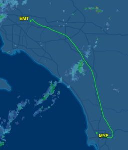
We flew for an hour, and then about 20 miles away from MYF, the controller started giving me vectors to gradually turn me around and line up with the ILS (Instrument Landing System). At right is the actual ground track from our flight. That bump out to the east near MYF is the result of those gradually turning vectors.

His vectors made us skip over most of the standard approach segments, which was confusing enough, and then he was giving us altitudes also seemed lower than the specified approach (but maybe that is fine?). Once on the ILS, things got better: you line up with a radio beacon coming from the airport and then keep it centered, horizontally and vertically, to end up right at the airport.

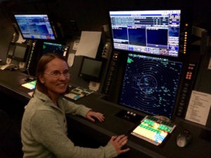
At about 700′ off the ground, David let me take off the hood — and I saw RUNWAY in front of me! I had a very nice landing and then taxied to the transient parking area. We shut down the plane and then too a Lyft to the SoCal TRACON center. The tour was excellent! Here’s what the control room looks like (with no people inside):

They let us sit at the controls in a training room:

And then we took a Lyft back to the airport for our return flight.

Since I was wearing a hood while flying, I couldn’t look outside the plane nor take any pictures. So I took pictures on the way back instead :)

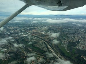
Here is a residential area not far from MYF, soon after taking off:

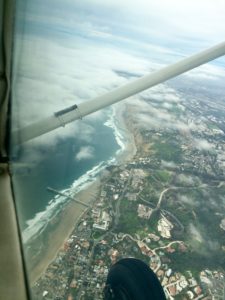
Here we crossed out over the coast:

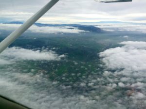
The clouds grew thicker beneath us:

In a break in the clouds, I spotted a little runway! We weren’t going there, but it’s always nice to spot nearby emergency options.


And finally, we made it back to El Monte! Very eventful and exciting day.

Flying to Rarotonga

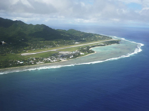
The Rarotonga International Airport (RAR) has a runway that is 7,638 feet long.

I am flew there on a 777-200. That seems like a rather short runway for a big jet. I’ve landed on longer runways myself (like San Bernardino or Ontario). Curious, I looked up the minimum runway length for a 777-200. According to the Air Cyber Alliance, it is 8,563 feet. Yes, that is longer than the Rarontonga runway. Eeek?

Minimum runway lengths are dictated by how much space the plane needs to take off (which is generally longer than the space needed to land. Yes, this means planes can land somewhere and then be unable to take off again). The minimums are calculated for the aircraft when fully loaded, at max gross weight. So one way to take off in less distance is to reduce the load – fewer passengers, less cargo, or less fuel.

According to the seat map, my return flight is nearly or completely full of passengers, so they won’t go that route. And they can’t skimp much on fuel: the flight from RAR to LAX is quite long (4,688 miles, 10 hours) and the 777-200 has a maximum range of 5,240 miles when fully fueled. Plus, you don’t just take exactly enough fuel to get there; you need extra fuel in case you have to divert or circle or otherwise go out of your way. So maybe they just reduce cargo?

I noticed that they schedule return flights to depart close to local midnight – probably trying to use the coolest part of the day to improve the plane’s performance. And by “coolest”, I mean 78 F. Challenging for flying. I want to chat with these pilots!

Cornelia Fort and WWII

On December 7, 1941, Cornelia Fort was up on the air giving a flying lesson near Pearl Harbor when the Japanese bombed it. “I jerked the controls away from my student and jammed the throttle wide open to pull above the oncoming plane,” she wrote.

“The painted red balls on the tops of the wings shone brightly in the sun. I looked again with complete and utter disbelief. Honolulu was familiar with the emblem of the Rising Sun on passenger ships but not on airplanes.

I looked quickly at Pearl Harbor and my spine tingled when I saw billowing black smoke. Still I thought hollowly it might be some kind of coincidence or maneuvers, it might be, it must be. For surely, dear God…”

She quickly landed her plane and ran for shelter with her student while Japanese fighters strafed the area. She was 22 years old.

Cornelia survived the attack. Other civilian pilots were not as lucky. She returned to the mainland and joined the Women’s Auxiliary Ferrying Squadron, a precursor to the WASP program.

“We have no hopes of replacing men pilots. But we can each release a man to combat, to faster ships, to overseas work. Delivering a trainer to Texas may be as important as delivering a bomber to Africa if you take the long view.”

Tragically, she died just two years later (age 24) in a mid-air collision with another ferry pilot. She was an excellent pilot and no doubt would have gone on to do other great things. How I wish I could have known her!

« Newer entries · Older entries »