My first air race!

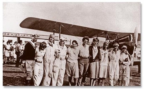
On August 18, I participated in a special event to commemorate the 90th anniversary of the first all-women’s air race in 1929. That historic event featured 20 women pilots (including Amelia Earhart and Louise Thaden) and was a challenging nine-day race from Santa Monica, CA, to Cleveland, OH.

Here in 2019, I gathered along with 13 other pilots to fly the same first leg of the 1929 event, from Santa Monica to San Bernardino, in an event sponsored by the Los Angeles 99s. It’s a distance of about 70 miles. I was flying a Cessna 172 with 160-hp engine – a solid plane but not exactly a racing machine. I’ve been to Santa Monica several times, but I’d only flown to San Bernardino once, three years before. I plotted a route over Dodger Stadium and north along the foothills before turning south at the end for San Bernardino. I picked an altitude of 3500′ since I figured that, for this relatively short flight, any benefit gained by flying at 5500′ would not offset the cost of climbing, especially in this particular plane.

We had a delayed start just getting to Santa Monica due to a lingering marine layer, as often happens this time of year. My co-pilot Tara and I were ready to leave El Monte to fly to Santa Monica and start the race, but we had to sit around obsessively checking weather reports until I judged it safe to proceed. It worked out great – when we reached Santa Monica, the clouds were still there, but just high enough that I could fly my typical altitude and maintain a safe separation. We landed and joined the other pilots prior to the official departure.

Period attire was encouraged, and the other pilots were decked out in flying suits, leather caps, scarves, and goggles. Wow! I didn’t have anything that cool, so I wore a polka-dot dress that could almost pass for 1920s. I will say that flying in a dress is rather inconvenient – I had to flight with my kneeboard to get it positioned 🙂
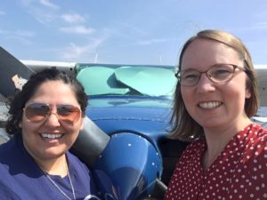
Departing Santa Monica was a bit of a scrum. Several racing planes had already departed, but the radio traffic on ground control was still very busy with multiple requests for flight following to San Bernardino mixed in with regular Santa Monica traffic. After a long time holding, I finally got to taxi onto the runway to “line up and wait” and then we were off! Tara had the stopwatch to time our departure and landing.

I was able to follow my planned route exactly. I flew a lot faster than I normally do. We were making excellent time, about 130 mph ground speed (I think we were also favored by a tailwind). I monitored the engine temperature and other instruments carefully to ensure I wasn’t stressing the plane. It performed like a champ – I was even able to lean the mixture without it getting too hot. I maintained speed approaching San Bernardino. They instructed us to cross over midfield and enter the left downwind for runway 24. I was eying the runway and debating whether to request a short approach, but then noticed another plane on final and we were cleared #2, so no short approach. I turned in sequence, made a precise short-field landing, and was able to exit on the first taxiway, and when the wheels came to stop, so did the stopwatch! Our time from takeoff to landing was 40 minutes and 34 seconds.

It was fun being welcomed in to the FBO with ground crew directing us with hand signals – that always feels like special treatment. At the FBO, we had a lovely lunch and then were treated to a performance of songs from a musical that was written a while back about that first 1929 race! You can read more about the event in KCRW’s article.

Finally, there was the awards ceremony… during which we were delighted to learn that we received second place! We didn’t have the second-best time overall, but there is some complex handicapping math applied to normalize for different types of planes and engines, and apparently we did very well given the equipment we had. Hooray!

I flew us back to El Monte at a more leisurely pace. It was clear skies and easy flying back. I finished the day with a third superbly executed landing – super gentle and well controlled. It’s one thing to get somewhere quickly, but also important to finesse the landing at the end!
A $100 BLT

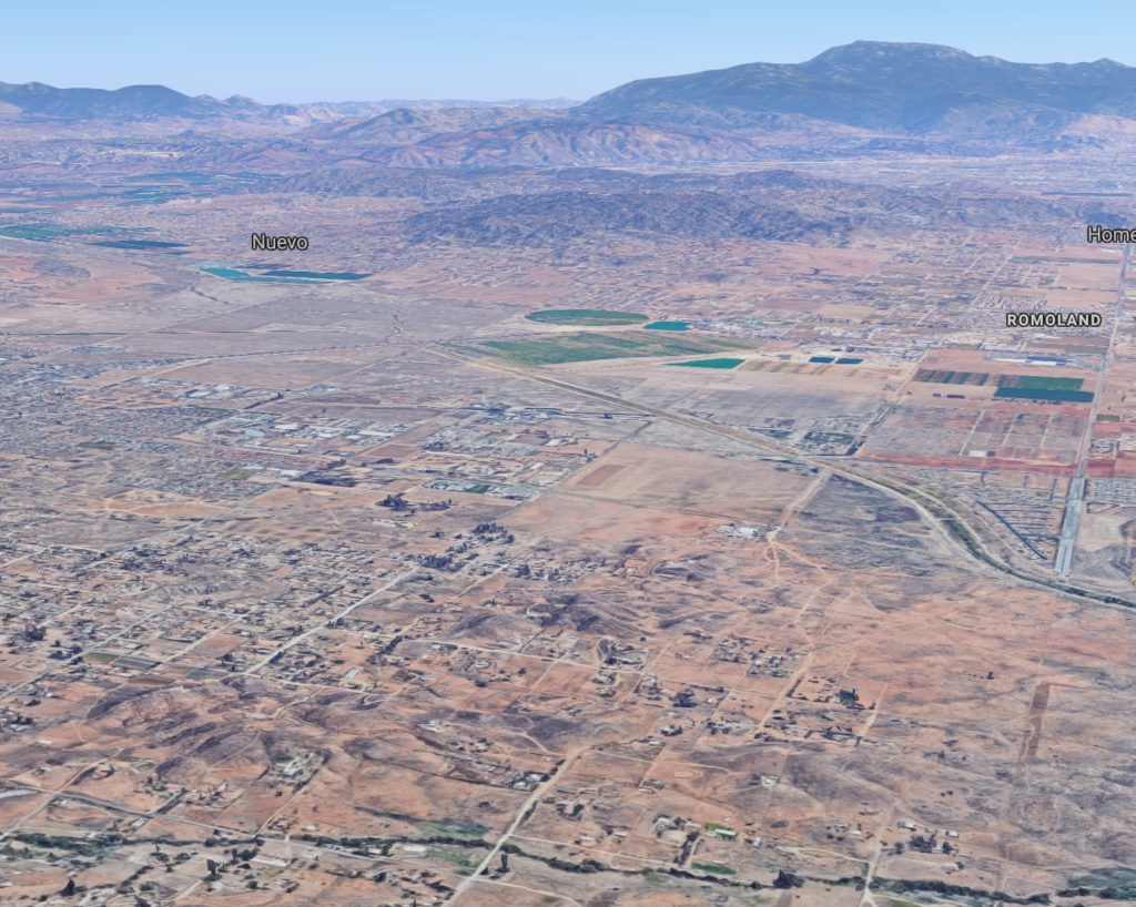
On Saturday, I flew to the Perris Valley airport (L65) for the first time.  The flight out at 5500′ was uneventful and rather quiet for a Saturday; I didn’t have any nearby traffic.  Perris is 44 nm from El Monte, or about 30 minutes of flying. I had the usual fun trying to spot a new airport — it’s not as easy as it sounds. Here’s the Google Maps 3D view which simulates about what it looks like as you fly in, hunting for the runway. Can you see it?


Perris Valley doesn’t have a tower, but there’s a guy on the radio (CTAF = Common Traffic Advisor Frequency) coordinating jumpers and planes. He was very friendly when I first called in and asked if it was my first visit, and then gave me a lot of helpful tips, including a wind check and guidance about where transient parking (for airplanes) is. I made right traffic for RW 15, bypassing the first 1900′ of dirt in favor of the asphalt for landing.

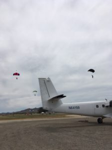
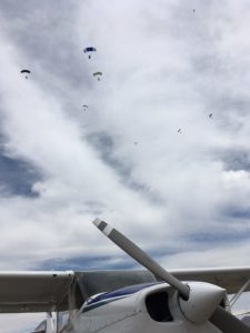
After landing and parking, I stepped out of the plane and felt a shadow cross over me and looked up to see a cluster of jumpers coming in to land over my head! Transient parking is right next to their landing field, which is just east of the runway. Obviously this could create some issues, and they clearly were busy keeping things safe and managing airplane and skydiver traffic together. In addition to my Cessna, there was a light sport aircraft that landed right after me, and two large planes with shark faces painted on that were doing formation takeoffs.

I walked (quickly and carefully) across the runway to the Bombshelter Cafe, where I had a tasty BLT and sat at a window to watch the periodic rain of skydivers coming in. I’ve never jumped out of a plane myself, so it was interesting to watch the range of techniques they use to come back to land. Some jumpers flared so lightly that their feet just brushed the grass before they settled down into a quick walk, parachute sinking and deflating behind them. Others came in fast, stuck their legs out straight, and landed butt-first, skidding along with the parachute dancing behind them. I can already say which landing I would prefer. :)

At right is a picture of the plane they use to take the jumpers up (a Short SC-7 Skyvan). It is fat and wide and squarish. It’s a twin-engine plane that sort of wallows its way into the air. Apparently it has good short landing properties, which is probably useful at Perris, since the paved runway is only 3200′ long. (Plenty long enough for me, natch.)

After lunch, I got the plane ready to go, but just as I was going to start the engine, another cloud of jumpers came raining down. In a bizarre coincidence, just that morning I read this article and therefore was on high alert. To be safe, I wanted to check in with the CTAF guy before starting my engine, so I pulled out my handheld backup radio: “This is the Cessna in transient parking, ready for departure. Is this a good time to start up?” He said it was fine, so I started up and followed instructions to back-taxi on RW 33 (the wind had changed to the north) and exit at the actual taxiway so I could do my engine runup. I then taxied up to the RW 33 threshold and declared that I was taking off with a left crosswind departure. The CTAF guy said “I’ll hold the jumpers here until you’re away,” which I appreciated. It still feels a weird and uncomfortable to have people walking around so close to an active runway! More high alert!

My flight back at 4500′ was also uneventful, although the first SoCal controller rejected my request for flight following because he was too busy. The second one picked me up and I cruised through Ontario’s airspace direct to El Monte. Overall, a fun lunchtime excursion!

Help improve flight safety

The FAA publishes NOTAMs (NOTices to AirMen… and women…) to alert pilots to conditions like closed runways or unlighted cranes that haven’t yet been added to navigational charts.  It’s a standard part of pre-flight planning to check the NOTAMs for your origin and destination airports.  For example, this paid off for me last summer when I learned that the Palm Springs airport had recently changed their ATIS (weather) radio frequency.  I didn’t have to flail around in the air wondering why I couldn’t pick up the transmission, which would be stressful right when you’re approaching your destination and preparing to land.

However, it can be challenging to sift through 50+ NOTAMs to find the ones that matter for your flight.  Some only matter if you’re flying IFR (under Instrument Flight Rules), which isn’t something I do (yet).  In addition, they are written in a cryptic format that can be an obstacle to figuring out whether or not a given NOTAM is relevant.  I recommend this great discussion about the challenges and frustrations of using NOTAMs.  There have been numerous requests to improve this system, but to date we are still using the format developed in 1924.

So I was thrilled to learn of an effort to get pilot feedback on real NOTAMs to assess whether they are (1) comprehensible and (2) critical to include in a pre-flight briefing.  You can participate too!

The very first NOTAM I got to review was:

!TJSJ 11/155 ABO OBST TOWER LGT (ASR 1203643)
182618.90N0663624.20W (4.0NM E ABO) 569.2FT   
(240.2FT AGL) OUT OF SERVICE 1711121110-1711271109

In human language, this a warning that the light on a tower near the Antonio/Nery/Juarbe Pol Airport in Puerto Rico (I had to look it up) will not be lit between Nov. 12, 2017 at 1110Z (i.e., time in UTC) and Nov. 27, 2017 at 1109Z.  Now, a tower without a light can be a problem because people have flown into such towers, with lethal results, which is why we put lights on them.  However, this tower is 240′ above the ground, 4 nautical miles away from the airport.  No airplane in its right mind would be anywhere near that tower unless it were doing an emergency landing.  Arguably, you would want to know about it if you were doing an emergency landing, but it’s not feasible to know about (and recall) every 200′-high tower along your entire route of flight just in case you suddenly try to land on one.  So I would judge this NOTAM to be not useful and yet another of the extras that clutter up the list.

One weakness of the survey is that it doesn’t give you any context for the flight, and context matters.  In the default FlightService briefing, you get NOTAMs not just for your origin and destination airports, but also for every airport within 25 nm of your flight path (this generates a nightmarish amount of spam when flying in the L.A. Basin).  In this case, is ABO my destination or just something within 25 nm?  Also, if it were a night flight, or if I were in a helicopter, I might care more about this NOTAM. 

The second one I got was more useful:

!TBN 12/017 TBN SVC ATIS NOT AVBL 1812282123-1812312200

This warns that the ATIS (weather service) will not be available from Dec. 28, 2018 at 2123Z to Dec. 31, 2018 at 2200Z.  Again, context matters; if this is the destination airport and my flight plan has me heading there between those dates/times, then I will want to look for other nearby sources of weather information and have those frequencies ready to go, or plan to query the tower directly (KTBN is an airport in Missouri, it turns out, that has a tower). 

I hope that the people behind the NOTAM survey are able to collect useful data and use it to help improve future notifications to pilots!

Crosswinds and poppies!

Last month, I flew to the Antelope Valley for an exhilarating combination of sightseeing, crosswind practice, and simulated engine-out operations.

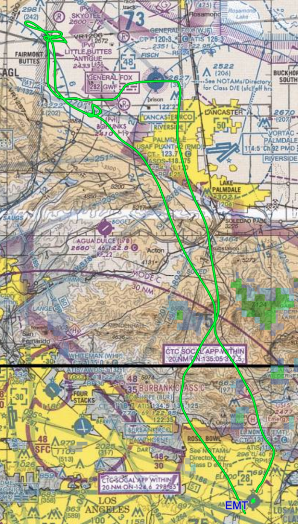
We took off from El Monte (KEMT) and flew north straight at the San Gabriel Mountains, climbing all the way. It so happened that the plane’s GPS was not working, so I got to exercise my piloting skills :) (“Aha, there’s Highway 2 and there’s the California Aqueduct and…”)

We crossed the mountains and descended down towards General Fox Field (KWJF). The winds were very strong and crosswind-y. I was heading for runway 24 with winds from 260 at 18 gusting to 27 knots. That’s a 6-9 kt crosswind, landing into a 17-25 kt headwind, and don’t forget that 9-kt gust factor! I was coming in for a left base entry, and boy, I could see how the wind from my left kept pushing away from the airport. I had to use a significant crab. On final, it felt like we were just crawling. The groundspeed was so slow that I kept wanting to add more power just to ensure we got there that century. But eventually, we landed and practiced good aileron positioning while taxiing back for takeoff.

The wind kicked up stronger for the takeoff: from 270 at 22 gusting to 30 kts. That put us at a 15-kt crosswind, 26-kt headwind, and indeed, taking off was a weird experience since we were immediately in an intense crab to stay over the runway. We climbed up and away to the west… to circle over the poppy fields!

My instructor, David Werntz, took some gorgeous pictures of the poppies, which were truly stunning:

After some sight-seeing, we did simulated engine-out practice. Back in the L.A. Basin, we can’t get very close to the ground in our simulated “landings”, so they always feel very hypothetical. Out in the Antelope Valley, we could pick a deserted area and get much lower (500′). This feels a LOT more realistic! Also: power lines have a bad habit of appearing out of nowhere when you get closer to that spot you’d LIKE to land on :)

We then flew back to KEMT, crossing the mountains again, this time at 7500′. While still above the mountains, my instructor suggested we try gliding all the way down to KEMT, deliberately not using the engine. A good test, given that it was around 10 miles away and 7000′ below us. So we glided and glided and eventually we still had extra altitude, so we ended up in a slip AND with flaps AND with S-turns (with tower permission). We had another crosswind (from 230 gusting to 14 kts for runway 19), but that felt tame after the wind at Fox Field. When we were about 10 feet off the runway, the wind shifted to come from the left (unexpected) and I had to work to combat the drift, but I got it all lined up and executed a smooth, gentle landing. Delightful!

Crosswind extravaganza

In April, I got to fly my mom out to Camarillo for lunch. It had been a blustery few days with rather high winds. In fact, the winds were strong enough that on the day before, the previous pilot in N54678 (the plane that I had booked) couldn’t land at our home airport (EMT). I watched his track on Flightaware and saw that after two attempts, he decided to divert to Brackett (POC). (Good call!)

Good call for him, but awkward for me; would I need to drive to POC to get the plane? Nope! He kindly offered to go early to POC the next morning to pick up the plane and return it to EMT for me. He tried to get a ride there with another pilot, but then *her* plane ended up having a failed seat rail! So then she DROVE him to POC and he flew 678 back! I really appreciated the extra effort!

Winds were calm at EMT, but I could see that they were forecast to be stronger at Camarillo (CMA). We took off and did some sightseeing along the way. Our plan was to attempt to land at CMA, but with the understanding that if it wasn’t possible, we would just turn around and cruise back to EMT.

Indeed, the winds did pick up as we headed west. As we got closer, I noticed that my heading and course were deviating by more and more. The wind was coming from the northeast, and the amount of turn required to stay on a westerly course was large enough that there was a distinctly unfamiliar “sideways” element to our motion (visually, with respect to the ground). It was even more noticeable on downwind, when we were closer to the ground. I’d never crabbed on downwind!

From 10 miles out, CMA was reporting winds from 070 (northeast) at 21 knots, gusting to 30 knots. That was the strongest and gustiest wind I’d ever attempted to land in, plus being a mild <= 5-kt crosswind (for runway 8). But I decided to give it a try. As I got closer, the wind was shifting more northerly, which was increasing the crosswind component. On downwind, it was coming from 040 but had died down in strength a bit to 16 knots (gusting to 29). That's a 10-18 knot crosswind, which is hefty for a Cessna 172. But no reason not to try; if I couldn’t maintain runway heading due to too much crosswind, I would go around (or simply depart). In fact, the plane before me did go around (eep?).

The tower cleared me to land and provided a final wind check: winds from 050 at 19 gusting to 29 knots. My heart was beating fast. I figured there was a good chance this would not be a landing, so I was mentally prepared to go around. I turned final and had on my extra 5 knots of airspeed as protection against the gusts, and I was managing to track the runway centerline. I was banked left, into the wind, with full right rudder to keep the nose aligned – a very strong slip! It seemed to take forever for us to get past the threshold and creep down over the runway – not surprising since it was a 16-25 knot headwind, which reduced our groundspeed on final approach from 65 knots to only 40-50 knots. I noticed that my right hand, gripping the throttle and carb heat (ready for go-around) was shaking a little. I think it was adrenaline :) because I didn’t feel scared, just extremely focused. The touchdown was fine. And then I felt a bit of wobbling drift, probably because I relaxed the ailerons (a good lesson on why it is so useful to envision the wind direction even when you’re on the ground!), but I regained directional control quickly. We exited the runway in triumph and taxied to the restaurant.

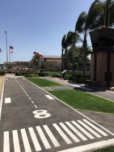
There was LONG wait for lunch, as is often the case at Camarillo. We passed the time enjoying the cute miniature version of the airport and ogling the windsocks (notice the flags, windsock, and palm trees at right). The forecast was for the winds to die down into the afternoon, so I expected that conditions would be better for our return flight.

After lunch, I got a weather briefing for our flight back to the east. There was a sigmet for moderate turbulence, and the northeast winds were predicted to swing around to the southwest at some point. It’s not often that you get tailwinds both directions! :) Ontario was reporting blowing dust (ick). Winds at EMT, however, were mild. Unfortunately, the winds at CMA had not improved as much as predicted; they were now from 080 (straight down the runway at least) at 18 gusting to 25 knots. Curiously, the winds at Oxnard (just 6 miles away) had changed to 290 at 12 knots, indicating that the front was indeed moving in from the west and we could expect a wind change at any minute.

I taxied out to the departure end of runway 8 and held short. As we sat waiting for a takeoff clearance, the windsock caught my eye. It was indicating wind from the west, NOT from the east – which would be a tailwind if I took off on runway 8. The front was upon us. Just then, the tower cleared us for takeoff. I reported the contradictory windsock to the tower, who responded that the wind sensor and windsock at midfield was still indicating wind from the east. Eerie! Well, I figured that I might as well try to beat the front and, by the time I was rotating for takeoff, I’d probably be into the easterly wind. And if things didn’t look good, I could always abort the takeoff. I had 6000 feet of runway at my disposal.

I took off and immediately encountered a flock of birds about 100 feet off the ground and reported it to the tower. I nosed down to fly under the birds, which made me pick up airspeed, which made my whole takeoff feel non-standard. I noted that the tower was now giving wind reports to other pilots coming in that included “low-level wind shear” as would be expected given the disagreeing windsocks. That’s definitely something to be wary of when coming in to land. But luckily, I was off the ground and climbing away.

Right about then the tower asked me to “report gain or loss midfield?” which I couldn’t process into a coherent question. Me: “Gain or loss of what?” Tower: “Report gain or loss midfield.” Me: “Say again?” Tower: “Frequency change approved, have a safe flight.” (Translation: “We’re done trying to communicate with you.” :) ) As I continued my climb (and switched frequencies), I decided that they were probably asking me if I’d noticed a sudden gain or loss of airspeed/altitude (which could occur if I passed through the front). Due to my evasive maneuvers, I couldn’t say whether the wind alone had affected the plane at that point. It’s probably still good that they warned other pilots of potential wind shear!

The rest of the flight back was uneventful and scenic. When it was time to land at El Monte, the local winds were very light – from 180 at 4 knots. I was very glad that it was so much better than the previous day and that we were not forced to divert. And I got some great crosswind practice and successfully passed that real-world test! (And took away notes for future improvements. There is truly a world of difference between theoretical crosswind compensation and actually doing and feeling it!)

« Newer entries · Older entries »